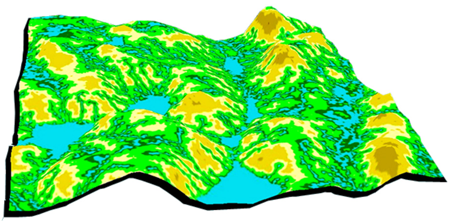


On February 11, 2013, Alberta Environment & Sustainable Reseource Development along with the Univeristy of New Brunswick and the Foothills Research Institute hosted a one-day workshop on Wet Areas Mapping. Presentations from the workshop looked at how the dataset is being used in Alberta, and where the technology is heading.
The Alberta Land-use Knowledge Network recorded many of the day’s presentations, available here:
- Barry White, AESRD – Opening remarks. Wet Areas Mapping: Where have we been and where are we going? View video
- Dr. Nicholas Coops – Introduction to LiDAR Technology View video
- Jae Ogilvie, UNB – Revisiting the 2011 Rainbow pipeline spill using Wet Areas Mapping View video
- Gordon Whitmore, DMI – Wet Areas Mapping: Merging strategic and operational View video
- Jae Ogilvie, UNB – Wet Areas Mapping: Modeling approach and technical issues related to product development View video
- Barry White, AESRD – Alberta’s Wet Areas Mapping: Building on our success & future mapping priorities View video
- Ron Sparrow, Trace Associates – Wet Areas Mapping: A powerful tool to effectively remediate & reclaim oil & gas sites View video
- Dr. Joyce Gould, ATPR – Wet Areas Mapping: Conservation Applications View video
- Chris Walsh, Devon Energy – WAM: A Premeditative Tool in Land Planning View video
If you are interested in seeing more videos on related topics, try these from a recent fRI Water Program workshop:
- Jay Mills – Riparian Vegetation: Identifying boundaries and quantifying structure using LiDAR
- Barry White – Can Wet Areas Mapping data contribute to riparian management?
- Rick Bonar – Riparian digital mapping using ecological boundaries in west-central Alberta
Gallery