Ben Williamson
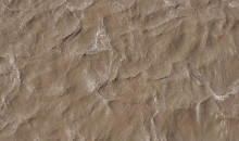
The day suddenly cools and the wind rises and the first hard drops spatter on the nearby mountains, on the willow leaves, on the road, leaving little dark pits in the dust. The tempo of the afternoon rain builds and soon the potholes fill and spill along the road, tumbling particles of sand and silt into the ditch. There they add themselves to the gathering stream. They accelerate downward, scouring the dirt, accumulating. One final drop over a vast precipice ten centimeters high and the sediment plunges into a creek.
Here the water is crowded with swirling grains, clouding a course that is still clear and fresh just a few metres upstream. The sediment is borne on downhill, paralleling the road above for a while before the road turns and crosses over the stream. Through the murk the cold-water fish of the foothills swim silently on, gills choking.

Two years ago, clouds swept over the same stretch of road in the east slopes of the Rocky Mountains. A truck door slammed and wipers flicked away the first drops. A muddy boot pressed gently on the peddle and the truck climbed back on the road, mountains in the mirrors. The woman had finished her last site for the day just in time.
Part of a team working on a tool that can predict problem sections of road for fish and waterways, her job was to measure how sediment makes it from road to stream in Alberta. The foothills have just a thin skin of topsoil coving the bones of the continent, and steep slopes scoured and scored by glaciers. We have logging trucks and off-road vehicles and massive trailers bearing oil and gas equipment all plying the gravel roads, bringing change to the landscape.
The data the woman gathered calibrated the tool – called Netmap – for our province. Already there are clear patterns. The steep, wide roads slough off a lot of sediment, as do those cut into slopes. Then there was the condition of the drains and ditches to consider, and the plants along the way, and finally, how stream crossings have been maintained over the years.
48 years ago an excavator lowered its bucket into the stream and scooped up the rock and mud of the channel’s bed and bank. Two men in hip waders rolled a steel culvert off a trailer and into the creek with a boom and a splash. The excavator returned the stone and earth, buryng the pipe. Then dump trucks crawled over top, gates ajar, spilling gravel in a steady stream to surface the new road.
The ribbed culvert collected sand and silt, and for many years, the company sent people to shovel it out. But in the new century, economic fortunes changed. Mergers and bankruptcies, assets traded and auctioned, and one day the market’s closing bell left this stream crossing ownerless, orphaned, and the shovelers stopped coming. The blue-grey metal bloomed red and brown with rust and gradually squashed down, slowly crumpling. The sediment built up year on year like cholesterol in an artery until today the stream, rushing fast and high from the storm, overtops the culvert.

The spiderweb of roads along Alberta’s rising western flank have a nearly uncounted number of stream crossings. Tens of thousands. It would be a disaster to discover that there were problems at even half of them. Last winter, Netmap began reporting what we can expect, watershed by watershed. It was good news.
90% of the sediment making its way off unpaved roads and into streams is likely coming from just 15–20% of all the roads. Focusing on just that modest minority could vastly improve the health of Alberta’s headwaters from the US border to Grande Prairie. Netmap also suggests where to add a small number of new drains that would stop four fifths of sediment troubling bull trout, a listed species.
The stream escapes around and over the restriction, fanning out into a dozen little rivulets and reforming. The banks wear slowly at first, willow roots resisting the onslaught, then all at once the sodden soil liquifies and they collapse, sandcastles before the tide. A plume of sediment extends hundreds of metres downstream, gradually fading as first the heavy sand and finally the silt settles down to bury the rocky bottom of the river, the small insects living there, and the food chain of the stream.

The Netmap team is passing the results to Watershed Councils, grassroots organizations that care for the rivers sustaining their communities. This summer, they will gather rubber boots and spades and go out to fix ditches, stabilize slopes by planting willows, and clean out abandoned culverts. They will visit the predicted problem roads and trails and record what they see.
The team will also be collecting more data to improve the tool. Today, the tool tells us which sections of road are most likely to be causing sediment problems. With the upgrade, it will tell us how much sediment the road segment will add to streams before and after it is fixed.
The stream will run clear and clean again, carrying away the silt bit by bit, exposing the gravel bottom. In December, a spotted silver and green fish with a pale pink stripe finds a quiet spot in the stream.
She gently digs out a redd in the gravel and releases her eggs.

Related:
Gallery