By Arya Horon
84 days. That’s the last time the moose team was out in the field. Suffice it to say, our biologists jumped at the opportunity to take a break from analysis and play in the woods for the day (in the name of science, of course).
The team started the week with boundless excitement about piloting a new drone-based protocol, however, wind and drones mix about as well as oil and water. Fieldwork was delayed day after day due to strong winds that could easily destroy expensive equipment, until finally the forecast was predicting a calm day. It was time for the moose project drones to take flight.
The Moose Research Initiative at fRI Research is an exciting new multi-pronged program that seeks to answer burning questions about moose populations in Alberta. For example, Research Theme 1 is investigating how moose populations have changed over the past 40 years, and Research Theme 2 is exploring where on the landscape moose like to spend their time. Research Theme 4 pushes the envelope even further. The team led by Dr. Nicholas Coops’ Integrated Remote Sensing Studio (IRSS) lab at UBC and Gord Stenhouse hopes to determine whether drones can provide a safer, cheaper, and more reliable tool for moose population surveys. Our goal this week was to do a first test of how well the drone would perform across a gradient of forest canopy coverage.
Leading the field work was Dr. Leonard (Lenny) Hambrecht, a postdoctoral fellow from IRSS, alongside IRSS MSc student, Hiroto Goto. Joining from Hinton were our two new moose biologists, Caroline Lesage and myself (Arya Horon), as well as Cam McClelland, senior biologist for the Grizzly Bear Program.
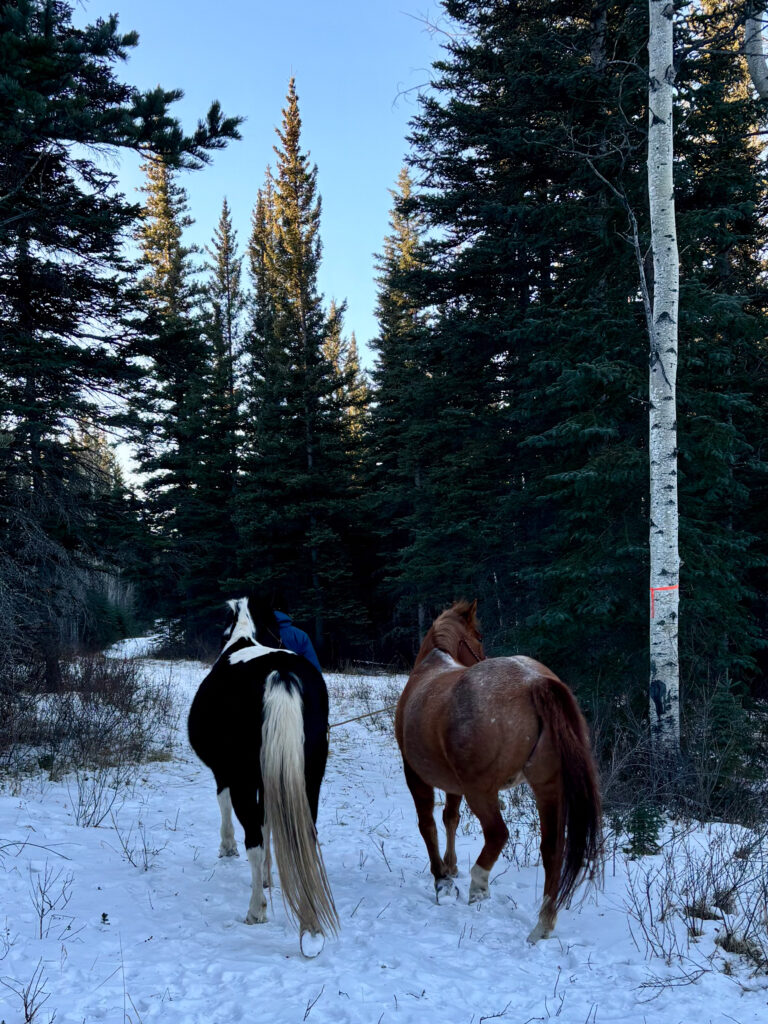
To achieve of our goal of testing whether moose are detectable by drone, you might be asking yourself: “How easy could it be to find a moose at the exact right time in the exact right location for a trial flight?”
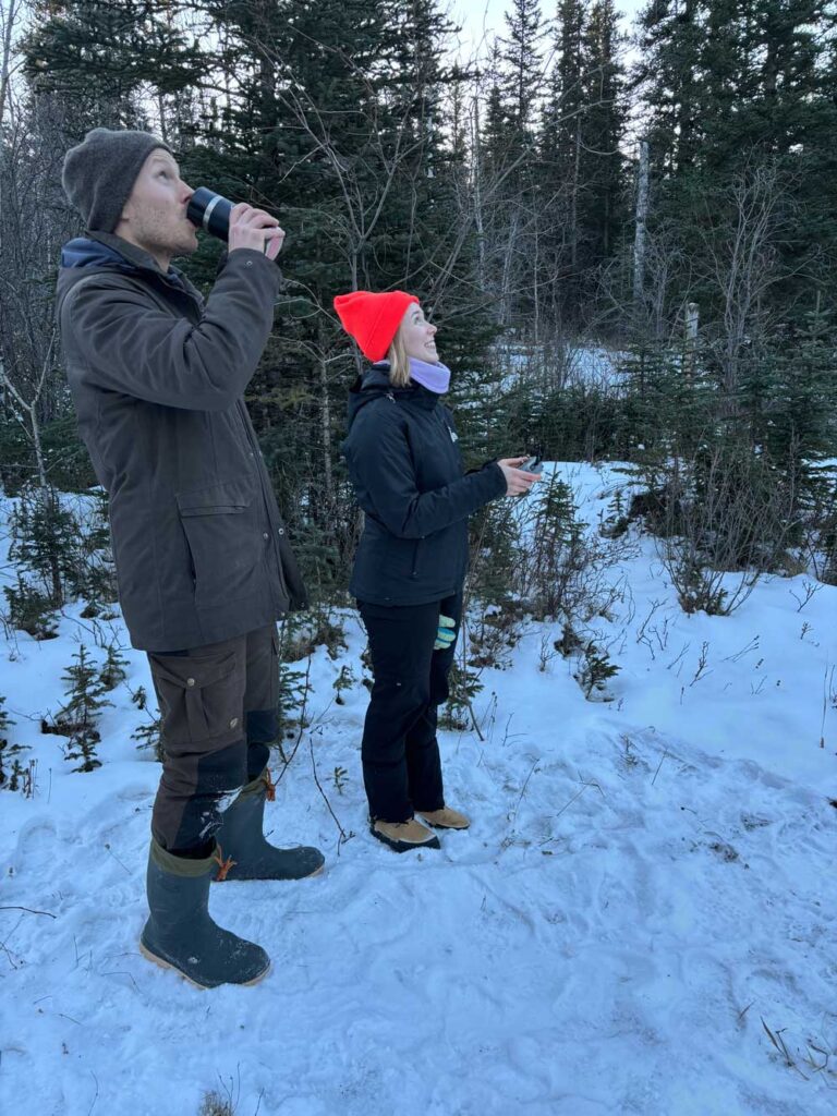
To avoid leaving anything to chance, we gratefully accepted the help of Cam’s horses, Virgil and Clifford, who were more than happy to play the part of “moose” for the day. And with that, the dream team was assembled.
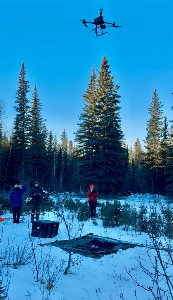
In much the same way all the best field days begin, we made a game plan over freshly brewed cups of coffee. Cam would wrangle his horses and meet us at the site, while the rest of us loaded up toboggans (it is winter fieldwork in Canada, after all) with precariously balanced gear. Pulling heavy sleds laden with equipment up the side of a hill is never fun, but many hands make light work, and we were soon one step closer to sending the drone into the air. As we waited for Cam to bring his horses around, Lenny walked us through his set-up.
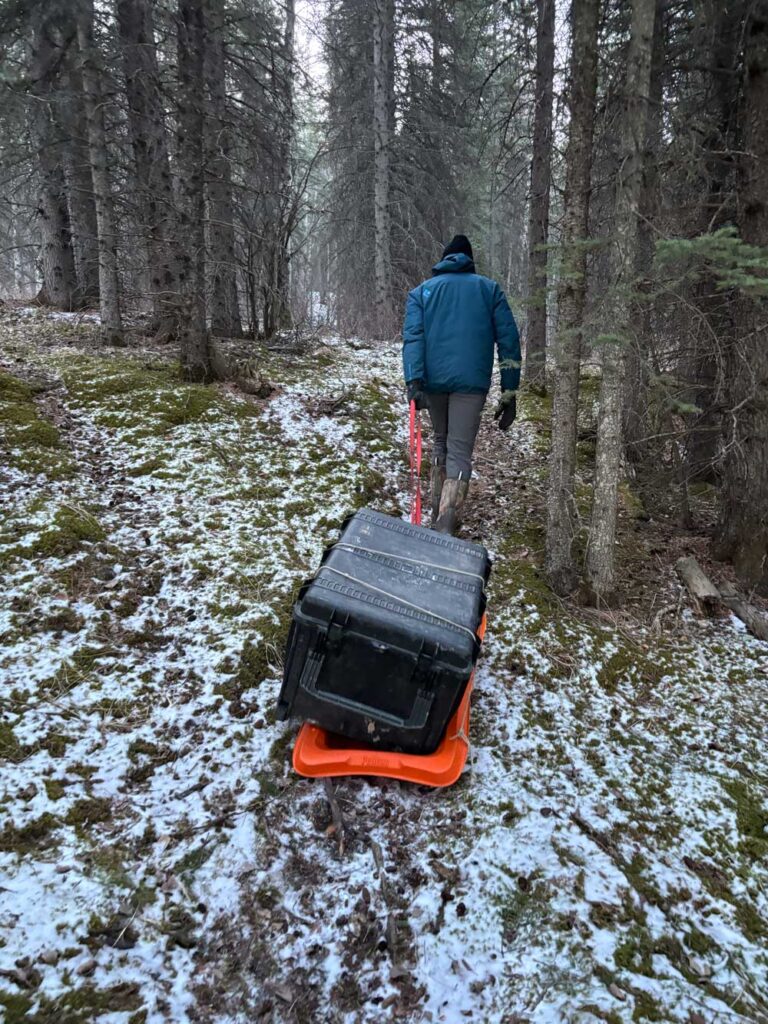
The first step was to set-up a tripod-mounted GPS unit that helps to boost the drone’s ability to know where exactly it is. Step two involved creating a suitable take-off and landing zone for the drone. No technical drone knowledge was required for this step, so Caroline and I quickly got to work stomping down a large square of snow to create a flat and (relatively) even patch onto which a tarp could be laid. The final touches included adding scavenged logs to the edges of the tarp to weigh it down. By the time the landing pad was complete, it was evident a couple biologists had been involved.
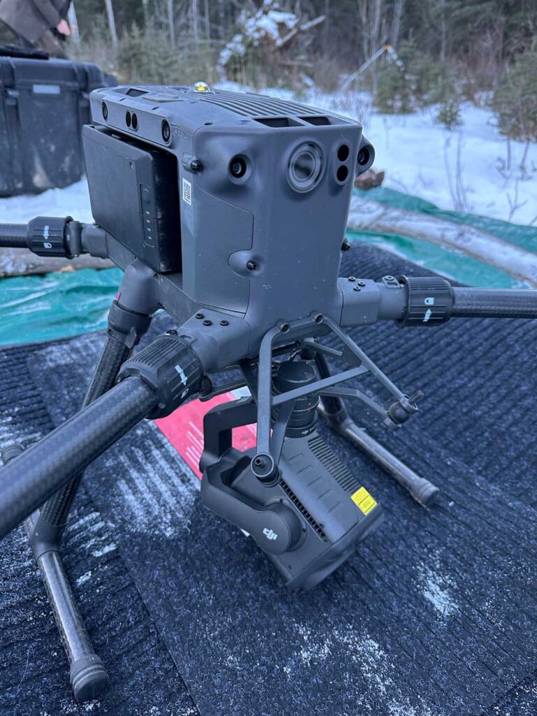
Then – the moment everyone had been waiting for – Lenny opened the largest box and revealed the high-tech behemoth nestled safely within. This particular drone had weathered the scorching heat waves of Australia like a pro but was now about to be tested for the first time in weather below zero degrees Celsius.
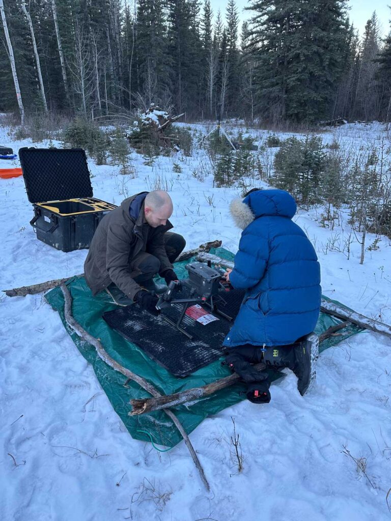
Drones of this breed require assembly. First, the propellers must be unfolded, then the two battery bricks slid into place, and finally the thermal sensor attached to the undercarriage. The thermal sensor allows this drone to record both colour vision images and thermal imagery during flight. Further, given the subzero temperatures, the battery needed time to warm up to a toasty 10°C before it would be ready to fly.
By the time the GPS unit was erected, the landing zone sufficiently stomped flat, and the drone assembled, Cam still hadn’t returned with the horses. With a mischievous grin, Lenny announced he had a surprise for us.
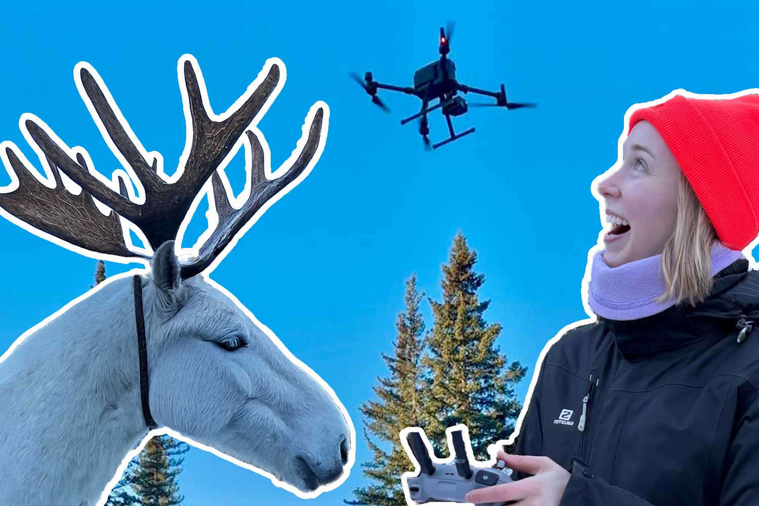
He had brought a mini drone! To fly drones above 250g, the operator needs to pass a test and get a license. However, this manufacturer had successfully created a drone that weighs 249g so anyone could fly it, even those without a license.
And fly it we sure did. This was the first time Hiroto, Caroline, and I had operated a drone, and while navigating the joysticks took some getting used to, we were able to slip into the skin – feathers? – of a bird in no time. It wasn’t long before we were all sold on the benefits of drone work for wildlife research and began daydreaming of ways to involve drones in future projects.
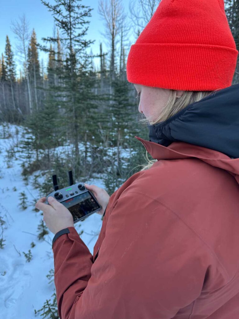
Left: Caroline flying the mini drone. Photo: Arya Horon. Right: Arya flying the drone under the supervision of Lenny. Photo: Caroline Lesage.
Soon enough, Cam had arrived with the horses, and it was time for the “real” drone to take flight. Unlike the smaller drone, when operating the research drone, the operator sets a flight path, and the drone does all the navigating itself. To do this, Lenny drew a rectangle on the controller’s touch screen over the area he wanted the drone to fly. After making a few minor adjustments, the drone was programmed and ready to go!
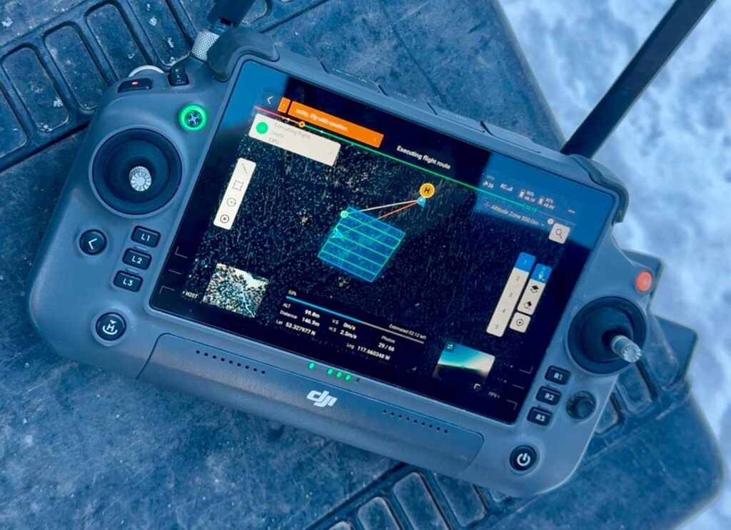
The first flight soared over a forest patch where the trees were relatively spread apart; this was our “easy” level. Over the course of the day, the drone flew over increasingly dense forest patches to test the limits of thermal and visual detection of the “moose” by drone. We won’t spoil the surprise (stay tuned for future updates) but rest assured that the team was happy with the results.
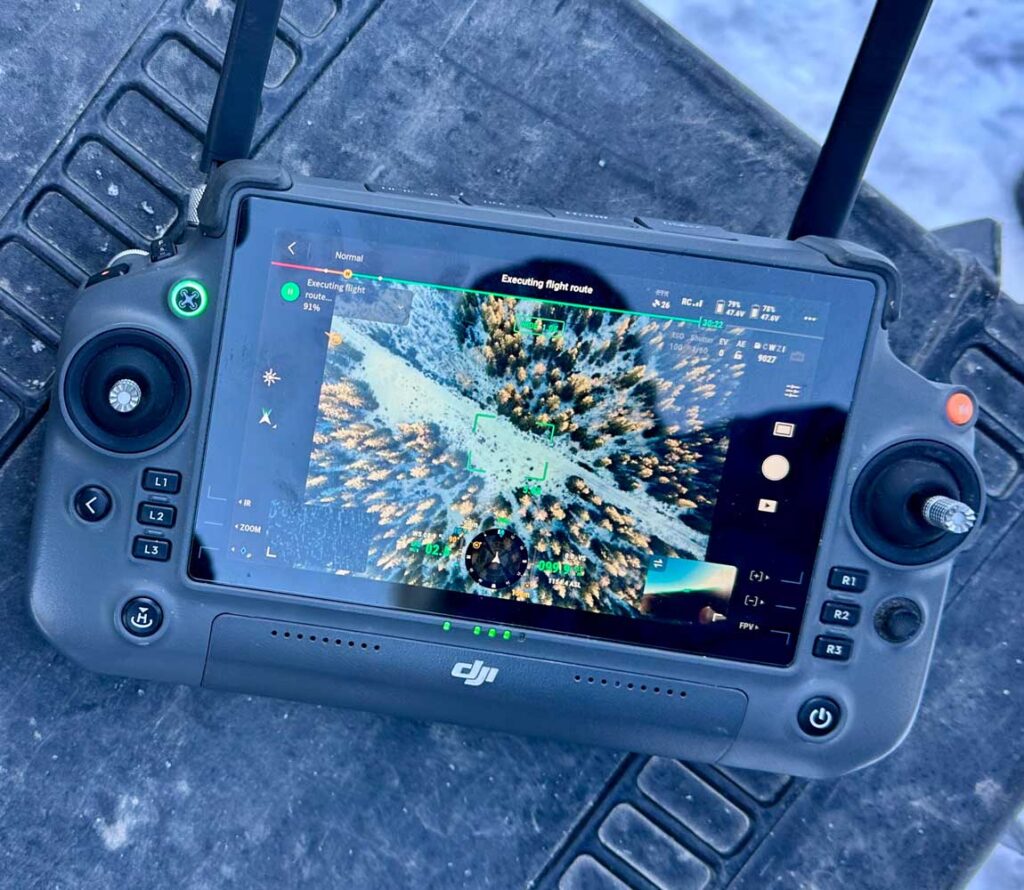
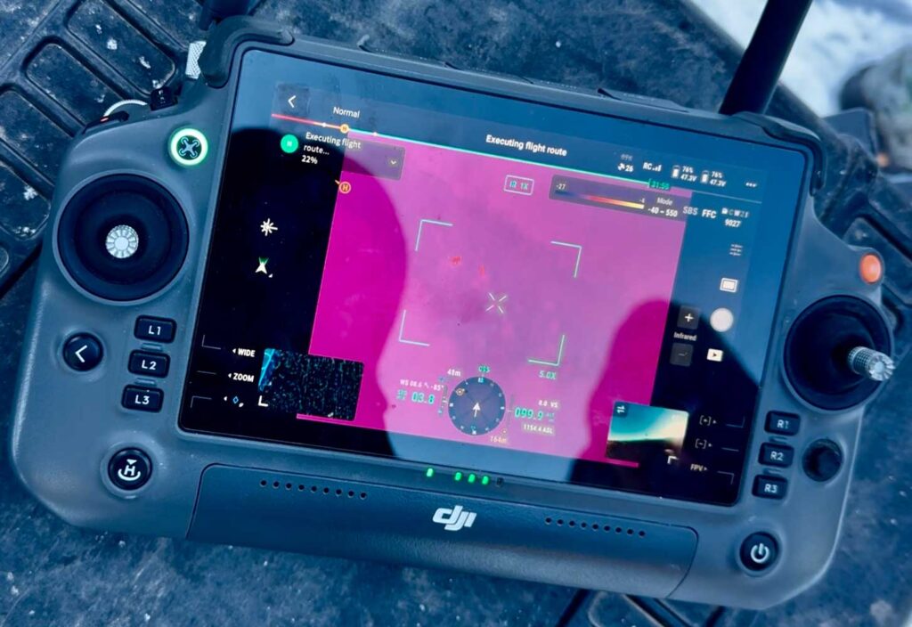
Left: View from the drone. Right: False-colour imagery from the drone’s thermal sensor. Can you spot the “moose?” Photos: Arya Horon.
Overall, the day was a soaring success with much needed data gathered to fine-tune drone protocols moving forward. It was such a fun experience to get the opportunity to learn from our colleagues at UBC, and we can’t wait to see what they discover with their drone-based research over the next two years!