The Land-use Knowledge Network expands as the province develops more regional land use plans
By Jeff Wiehler
Alberta’s current approach to land use planning dates back to 2007, when the Land-use Framework introduced a vision of economic and environmental prosperity for the province. fRI Research has contributed to this vision by providing resources, research and information for planners, planning practitioners and land use decision makers.
The Land-use Knowledge Network was launched in 2011 and the Land Use Planning Hub in 2018. These two tools continue to grow and support research-based land use decision making throughout the province.
State of regional plans in Alberta
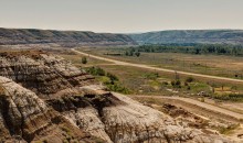
To manage the use of land in the province, an array of policies and strategies have been implemented since the beginning of the century. Here is a detailed history of land use planning in Alberta.
Alberta’s current approach to regional planning originates in 2007, when the Land-use Framework was released. This document provided the blueprint for creating seven regional plans that guide the long-term development and use of land throughout the province. In 2009, the Alberta Land Stewardship Act provided the legal basis for the province to create and implement regional plans.
There are currently two regional plans that are active: The Lower Athabasca Regional Plan (LARP) was introduced in 2012 and the South Saskatchewan Regional Plan (SSRP) was introduced in 2014.
The North Saskatchewan Regional Plan (NSRP), which covers the region surrounding Edmonton and includes municipalities extending from Banff National Park to the Saskatchewan border, is currently under development. After a round of public consultation in 2018, the next steps and drafts are awaiting announcement from the provincial government.
Here’s the status of the seven regional plans in Alberta:
- Lower Athabasca: Approved
- South Saskatchewan: Approved
- North Saskatchewan: In development
- Lower Peace: Not started
- Red Deer: Not started
- Upper Athabasca: Not started
- Upper Peace: Not started

Supporting land use planning since 2011
The Alberta Land-use Knowledge Network was started in 2011 by fRI Research, and it is now an extensive database of curated research on land use planning. By organizing the resources into information pyramids, the Land-use Knowledge Network moves knowledge into practice. Here is a short presentation by Dr. Kirby Wright, the lead designer of the Land-use Knowledge Network, about how the website was designed to communicate new ideas.
As a partner website to the Land-use Knowledge Network, the Land Use Planning Hub provides resources to municipalities as they implement Alberta’s regional plans. The website was created in 2018 as a complement to the Land-use Knowledge Network and both will continue to support research-based land use decision making throughout the province as more regional plans are developed.
Next steps for our land use tools
New research, articles and information are added to both the Land-use Knowledge Network and the Land Use Planning Hub on a regular basis. Webinars on land use topics are planned for 2019 to continue to share resources with planners and practitioners that are involved in land use decisions in Alberta.
To receive the latest updates from both the Land-use Knowledge Network and the Land Use Planning Hub, sign up for the Alberta land use newsletter or follow the Land-use Knowledge Network’s Twitter or Facebook pages.
Gallery