Reconciling Pre-industrial Patterns, Caribou Habitat, and Management Reality
To what degree, and at what scale(s) is it possible to cluster forest harvesting activities across whole landscapes?
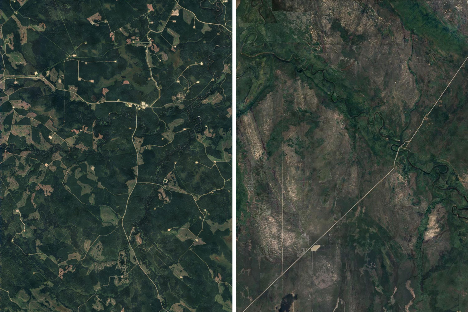
We know that natural wildfire in the boreal forest tends to cluster at intermediate (10,000-50,000 ha) scales. This means that even on landscapes with high levels of fire activity, there was always significant areas with no disturbance (which happen to favour species such as woodland caribou). In other words, disturbance clustering is not only a natural phenomenon in the boreal, but also potentially helps explain the persistence of caribou on these disturbance dependent landscapes.
In contrast, forest harvesting has for decades spread disturbance out in an effort to minimize local impacts of harvesting and the associated perceived risks to individual values. Decades of harvesting under these policies and practices have created more homogenous managed landscape patterns.
Why Is this Important?
There are several good reasons to shift to a more aggregated approach to harvesting. By focusing harvesting in a small number of locations for 10–20 years at a time, it maximizes the likelihood of having large areas with little or no industrial activity for that same period. These areas could become candidates for road and seismic line restoration and next generation habitat for caribou. The location, size and shape of aggregated harvesting could also help breakup continuous fuel for wildfires, effectively cooling the landscape through strategic harvesting.
Although sound in theory, we do not know if or to what degree it is possible to cluster harvesting on these managed landscapes. Similarly, we do not know if or to what degree such a strategy might have on improving woodland caribou habitat needs. Nor do we know the impact of doing so on other economic, ecological, and social values. This collaborative project seeks to answer these questions using scenario modelling exercise on four caribou ranges across two different provinces.
Objectives
- Obtain a better understanding of if, and to what degree, spatial clustering of anthropogenic disturbances is possible to create on the ground, and how it varies under different conditions and policy scenarios.
- Assess the potential impact of various scenarios on woodland caribou habitat and other values.
- Understand if natural range of variation aligns with proposed harvesting pattern changes to improve woodland caribou habitat outcomes and whether forest management activities can closely approximate these