


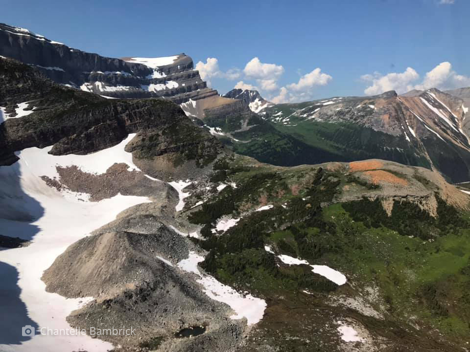
Understanding Mountain Pine Beetle Impacts on Upper Elevation Sites in Jasper National Park
Our goal in this proposed project is to test the potential for oblique image analysis in detailed mapping and change detection on upper elevation habitats (subalpine and alpine ecoregions) in Jasper National Park. These habitats are home to two endangered Pinus tree species—whitebark pine (Pinus albicaulis) and limber pine (Pinus flexilis)—that are subject to mountain pine beetle (Dendroctonus ponderosae) infestation in addition to impacts from white pine blister rust (Cronartium ribicola).
Objectives
- Conduct repeat photography for upper elevation habitats in area of critical concern for whitebark and limber pine and mountain caribou in summer 2022 and 2023 according to strict protocols developed by the MLP.
This painstaking work depends on close ground support of JNP staff, good weather/smoke conditions, and a strong photography/climbing team. Each photographic station (a discrete location representing between 4 and 16 separate images) requires several hours for photography, in addition to gaining access and returning safely. Given contingencies of weather, smoke, and logistical support, we estimate a one month window in each summer season. We will also deploy existing third view imagery provided through work conducted by James Tricker in 2019 and 2020. Fieldwork will be under the leadership of Jenna Watson, a new graduate student, with support from the MLP team. - Test the effectiveness of machine learning-assisted feature classification of upper elevation habitats.
To classify the oblique photographs, we will use the machine learning (Artificial Intelligence) software package PyLC (https://github.com/scrose/pylc) developed in-house at UVic by our research team and based on DeepLab algorithms (see Chen et al. 2017). DeepLab is a leading semantic image segmentation system implemented in TensorFlow, an open-source platform for machine learning. We will train the DeepLab model to segment and classify land cover in oblique photographs using new manually classified masks of upper elevation sites as well as previous classified images from valley locations. Tests will be conducted against machine and manually classified. - The masks produced by the PyLC software will be geo referenced using a new workflow in the Image Analysis Toolkit.
This is work is undergoing substantial development presently by MLP researchers James Tricker and Claire Wright. The result will be land cover maps of upper elevation site for 1915, 1998, and 2022/23. A special focus will be on identifying landscape features of particular concern, including beetle-impacts upper elevation forests/krummholz, subalpine meadows, and areas of residual summer snowpack (Swetnam et al. 1999). - We will explore with Laura Chasmer and Chris Hopkinson using contemporary remotely sensed data for assess biomass, and then backcast to historical imagery to model biomass change over time. These methods are still very much under development.
No publications tagged
Dr. Eric Higgs