


Using Innovative Techniques to Understand How Mountain Pine Beetle is Shifting Ecosystem Composition and Configuration in Jasper National Park
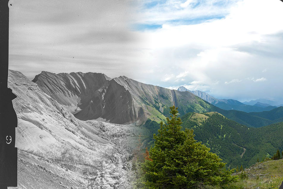
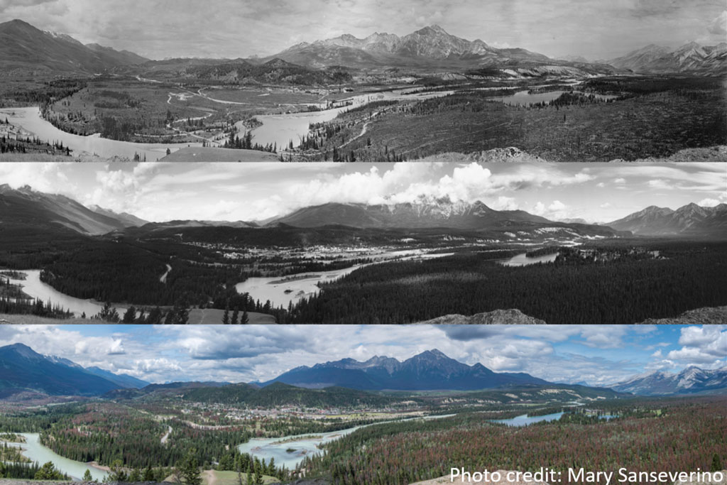
It is unknown how the disturbance associated with the MPB outbreak has altered the ecosystem in Jasper National Park, and this project will investigate how MPB has impacted the historical range of variability in the park. This will be done by using an innovative technique to derive landcover information from the oblique image collections of the Mountain Legacy Project and use this as a baseline for comparison with more recent landcover information to quantify changes in the ecosystem. This information will assist Parks Canada in making decisions around restorative interventions, application of fire-smart programs, and other operational and education initiatives.
Objectives
- To test the accuracy of a new approach to classifying and georeferencing land cover data from repeat oblique photographs against comparable data produced from satellite and aerial orthoimagery.
- To Apply the above approach to the historical survey photographs to develop a 1915 land cover map for a portion of JNP (the “three valley confluence” near the town of Jasper).
- To Derive additional land cover data from 1949 aerial photographs, 2002/03 Landsat 5 TM satellite imagery, and 2020 high-resolution aerial imagery.
- To quantify the changes to land cover types (i.e., configuration and composition) in the JNP study area since 1915 in order to evaluate the impact of the MPB outbreak on HRV and assess the potential for changes in ecological processes that may lead to regime shifts.
This briefing note introduces a project that will develop a new method for classifying and georeferencing land cover from oblique […]
Dr. Eric Higgs
James Tricker
Dr. Jeanine Rhemtulla