By Dan Wismer, GIS Analyst
Fall 2021 update: you can explore an up-to-date version of the webtools with this Story Map.
It was summer of 2017 when Barry Nobert, one of our Caribou Program’s wildlife biologists requested that the GIS program build a new set of data processing tools for our partners. Building custom tools is nothing new for the GIS program, but this request forked away from what has traditionally been done in the past. We tend to build custom tools using python and leveraging Esri’s arcpy library. Python script tools can then be shared through zipped folders and extracted to run and execute in ArcMap. This method is tried and tested with proven utility. However, this approach can lack in accessibility and the need to know your way around Esri software. With those limitations alone, some of our target users tend to get unintentionally filtered out.

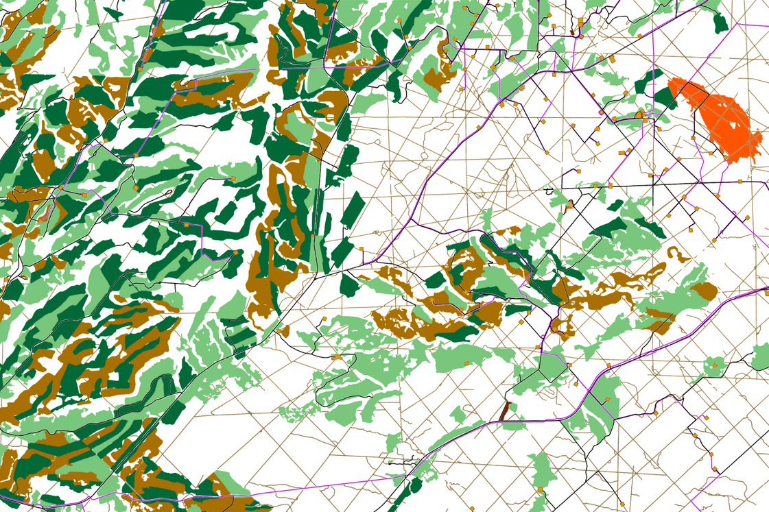
An RSF map of the Little Smoky range viewed in ArcMap by ESRI.
For these new set of tools, we wanted to bring data processing and analysis solutions to the web—a project idea I have always been keen on building. Delivering GIS solutions through the web is a modern way for our partners to interact and consume the science being developed at fRI Research. To do this, we turned to the R environment and its Shiny framework. R is a powerful language capable of performing GIS tasks, and the shiny package makes it possible to build reactive web applications.

The data viewer in the Webtools allows users to preview their changes before running the model.
Coming from an ArcMap / python background, working and executing code in R required learning new ways of doing familiar operations. Starting from basic tasks such as how to read a shapefile into RStudio, to reclassifying rasters with overlay conditions. Working on this project I stumbled my way through how and how not to do things. The application in version 1.0 consists of four unique tools and over 6000 lines of code. R packages that were integral for the server side code to run include rgdal, rgeos, raster, leaflet and gdistance to name a few. But the most important package was gdalUtils, which allowed us to rasterize vector footprint data at reasonable speeds as the workflow was heavy on raster processing. With the tools being rendered on a browser, we could then polish up the look and feel of the site to how we wanted, implementing CSS to our HTML.

The Caribou Webtools suite homepage. Four tools are currently available.
The final product created was Caribou Webtools, version 1.0. The Webtools are designed for land-use planners to predict how woodland caribou habitat will change under different management scenarios in west-central Alberta. These scenarios can both add and restore features on the landscape, such as cutblocks, wellsites, wildfires, roads, pipelines, seismic lines, and buildings. Below is a video demonstrating the Cougar RSF tool in action. Much like the other three tools (Caribou RSF, Wolf RSF, and Caribou Connectivity), the cougar resource selection function predicts areas of good and poor habitat with reference to terrain variables and footprint features found or taken off the landscape.
For future versions of Caribou Webtools, we want to add additional functionality in the browser where users can draw boundaries directly on the basemap. In addition we would like to develop more operational tools, such as percent disturbed or costs summaries with reference to management building and restoring scenarios. Completing a project like this has opened up all types of new ideas in tool development, making it exciting as ever to be a part of.
Gallery