Ben Williamson
When Alex Chubaty began his post-doc, he was taking on a big problem. An ecologist specializing in insect behaviour, Chubaty joined Eliot McIntire’s lab at the Pacific Forestry Centre to try to get a handle on an insect that was behaving in a particular damaging way to BC’s forests, and was well on its way to devouring vast numbers of lodgepole pine in Alberta. Chubaty’s challenge was to model the spread of mountain pine beetle at very large, landscape scales. But as it happened, this was a way into an even bigger project.
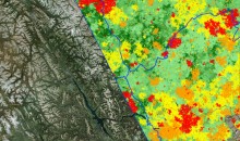
At the same time, McIntire was beginning work on a set of models for the Healthy Landscapes Program that could simulate how landscapes in western Canada have changed and will change over the centuries because of things like climate, fire, and industry. Writing a spatial model to get answers has become a very common approach—for our programs and labs across the country—but McIntire needed a way to get several discrete models and data sets to talk to each other. That turns out to be far less routine.
“We couldn’t find an existing platform that could address the large spatial areas we were considering, and which was easy enough to start using,” says Chubaty. The few things that are out there have technical limitations, poor outputs, restrictive licenses, or weren’t written in a common coding language. “The more we talked about it, the more it was clear that we could write our own.”

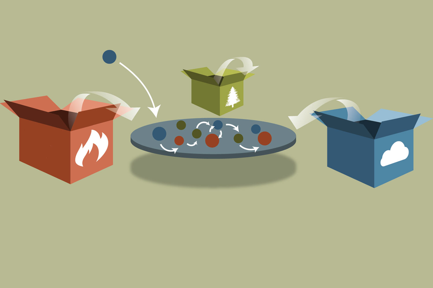
So in 2014, along with the mountain pine beetle model he had signed up to build, Chubaty began working with McIntire to also create a platform that could handle the multi-way interactions of landscape ecology. Because it was designed to integrate many different disciplines, they gave it the general name Spatially Discrete Event Simulator, or SpaDES for short. SpaDES would be able to do more than just help them answer their own research question.
They decided early on that as long as they were knocking down the walls between fire, climate, land use, and insect ecology, they may as well go all the way. Chubaty and McIntire made it open source under the General Public License v.3 so anyone can freely use and modify SpaDES for their own research. They also made the critical choice of writing it in the programing language R.
“We knew R is flexible and powerful,” says Chubaty. “It can do visualizations and graphics, it can take advantage of high-performance computing, it’s cross-platform, and most importantly, it’s familiar to ecologists.”
Familiar might be an understatement at this point. Forget the Latinate Genus species—the lingua franca of spatial ecology is increasingly install.packages().
Their first version of SpaDES was actually put together fairly quickly, but Chubaty and McIntire continued to develop it in parallel with the mountain pine beetle and Landweb models that would run on the platform. Chubaty’s expertise was insect behavioural ecology, not pure computer science, so there was a learning curve to the job. But if anything, the background in a specialized field has let him appreciate the full value of SpaDES to all the research groups across the country (not to mention within fRI Research).
“There are a lot of silos,” says Chubaty. “Collaborations are hard. Modellers do something, spit out a result, then the next group in the chain takes that output and does something else, and so on. There isn’t a lot of the kind of integration that we’re talking about, where policy makers say, ‘here’s what we need to know,’ and then insect people, fire people, veg people, econ people can all be involved at every step. Because their models talk to each other, the research groups have to talk to each other, and so every group benefits from one another’s expertise. The models and data can be put together in novel and useful ways.”

Chubaty sees the culture in science changing to become more open and collaborative. He points to permanent data repositories popping up, and the increasingly common practice of sharing code. SpaDES is right at the crest of this new wave of sharing and transparency because it requires open data, and it allows integration of any number of disciplines, on top of allowing the exploration of interesting questions about cumulative effects and multi-way interactions.
With the SpaDES platform in good shape, in early 2018 Chubaty took over the last phase of development of the LandWeb models that McIntire began. The LandWeb suite really is an ideal showcase for SpaDES because not only does SpaDES tightly integrate the fire, climate, and vegetation regeneration models that make up LandWeb; it gives researchers the flexibility to, for example, swap out a data set when more measurements are made, or add an additional module to answer new questions.
LandWeb is just one configuration of models in the SpaDES platform. Chubaty and McIntire hope that the era of single-question, disposable models is over, and that SpaDES will lead the way to a more collaborative future. For example, researchers could plug in a dataset from their own study area and leverage the models already in the SpaDES platform, and forest managers could get their questions answered without having to start from scratch on every problem.
The tool has been built, but the project isn’t quite done. The Healthy Landscapes Program signed Chubaty up to roll out and maintain LandWeb , to remove every barrier to a practitioner using the tool. The first thing was creating a web portal that makes LandWeb accessible to everyone, with no coding knowledge necessary. Like the Caribou Webtools, there is nothing to install; users just go to website. With a few clicks, they can view and download the outputs—professionally designed maps, charts, and data layers—of the landscape’s natural range of variation for standard ecozones or forest management areas. As an extra perk, if users from funding organizations have their own specific area, they will be able to upload it and get the natural range of variation for any non-standard region they like.
As well as accessibility, another determinant of whether Landweb will be well-used is, of course, how reliable it is. All of LandWeb’s components have been peer reviewed and validated, and Chubaty has fully documented them within the tool. Finally, as LandWeb is rolled out this fall, the Healthy Landscapes Program is creating resources and hosting training sessions to help people understand and use it, so keep your eyes open for a session near you.
Gallery