Combining Field and LiDAR Modeling Tools to Move Beyond Indicator Based Approaches for Surface Erosion: Simonette as a Test Area for the Foothills Natural Region
This project on riparian mapping aims to improve management and operational efficiency by capitalizing on the high quality remote sensing data available in Alberta.
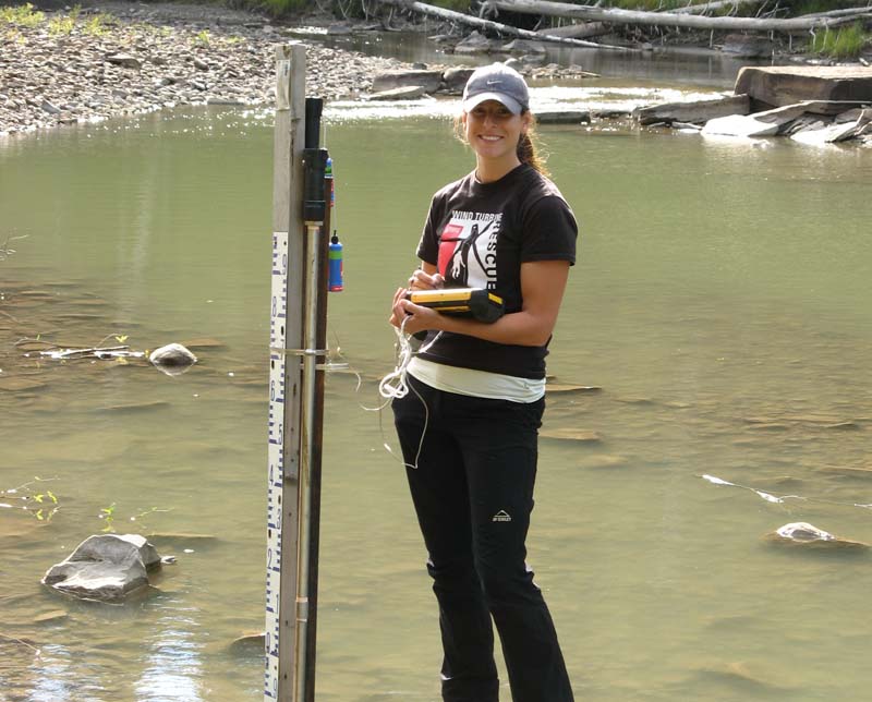
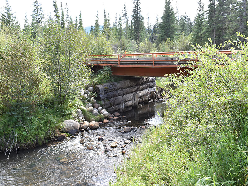
Watershed management for erosion, sedimentation, and riparian mapping is very labour intensive and expensive. Happily, Alberta has invested in LiDAR coverage for most of the green area. This project uses Alberta’s LiDAR data to tests tools developed elsewhere in order to make watershed management more efficient. This project covers erosion and sedimentation.
The other compenent to this project, Netmap for riparian mapping and improvement of a stream mapping layer, is identified as a priority for the Alberta Water Council and Forest Management Branch. This project will also generate data to kickstart that effect.
The goal of these tools is to better integrate watershed values to ensure sustainable forest and watershed management. We expect these tools to be especially useful where forestry is putting pressure on these watershed values.
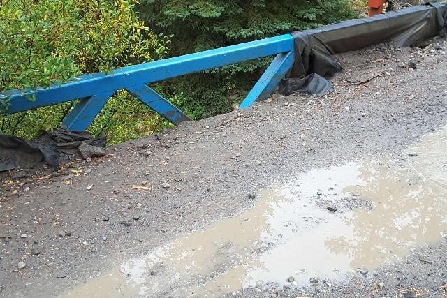
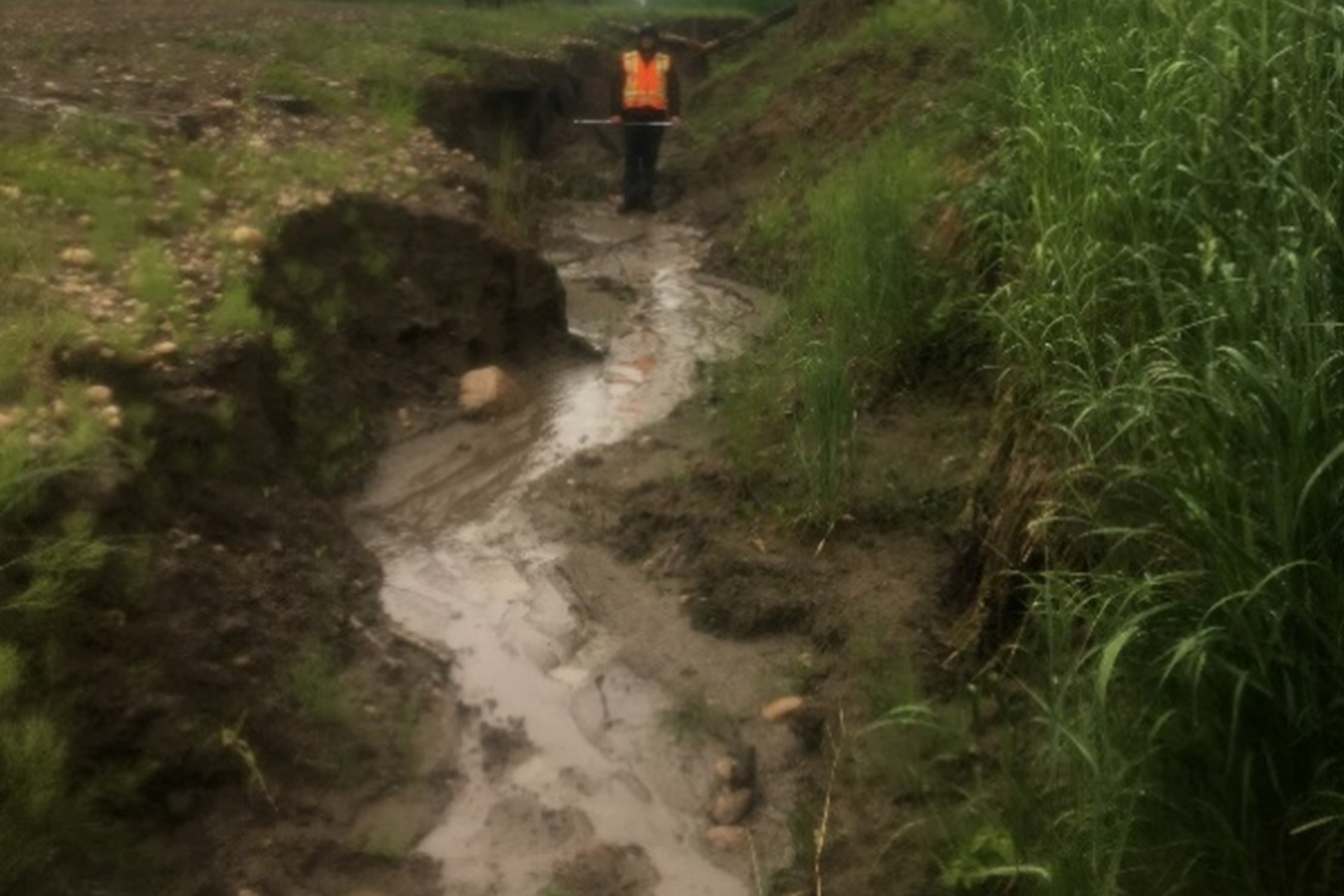
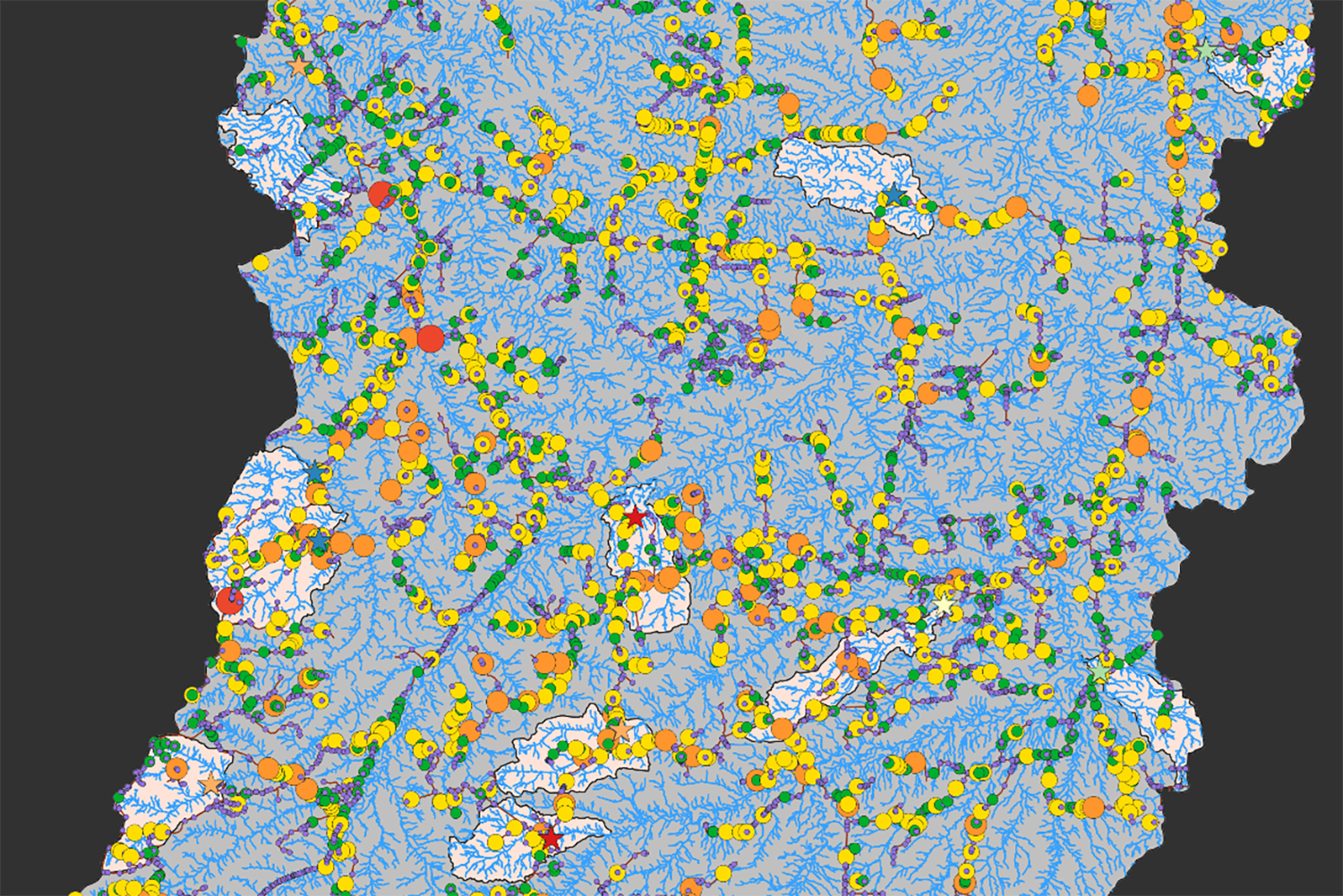
The road density indicator, required as part of the forest management planning process, shows increased pressure on fish populations of special concern. This project will validate NetMap and GRAIP (Geomorphic Road Analysis and Inventory Packag) to address this issue, and to determine if LiDAR models can improve the efficiency of the work by directing field crews to potential sites and tracking watershed scale impacts.
Objectives
This project on riparian mapping aims to improve management and operational efficiency by capitalising on the high quality remote sensing data available in Alberta. The goals are to:
- ensure that forest management policy and practices are effective and based on the best available science and technologies;
- ensure that the Alberta forest community continues to leverage Alberta’s considerable investment into quality aerial LiDAR data by furthering the development of a suite of LiDAR-derived planning tools;
- ensure that the Alberta forest sector remains competitive by reducing costs associated with planning field operations;
- ensure that the Alberta forest sector remains a leader in forest stewardship by minimizing it’s environmental footprint, particularly that in the context of the land and water interface.
Specific objectives are to:
- Determine the applicability of the Geomorphic Road Analysis and Inventory Package (GRAIP) to the forested regions of the Simonette watershed.
- Determine if the NetMap GIS tools are appropriate for modelling and tracking the erosion rates for the Simonette.
- Deliver the NetMAP GIS data to ESRD so the Forest Management Branch can explore the use of the tools for Riparian Mapping using LiDAR data.