Grizzly Bear Research Database
The GIS Program is centralizing and maintaining the Grizzly Bear Program’s massive spatial database.
Management of centralized grizzly bear research database supports multiple types of users. The Grizzly Bear Research Database is important because bear data can be quickly accessed and cross-referenced with other information, data collaboration opportunities exist with other agencies in Alberta, BC and in the US, and it helps to ensure the long-term conservation of grizzly bears in Alberta.
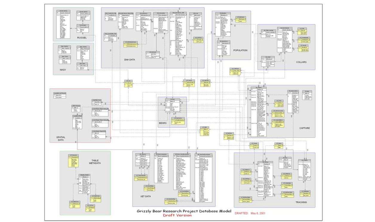
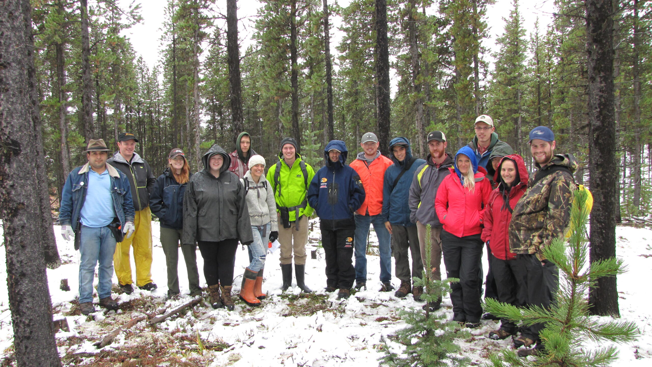
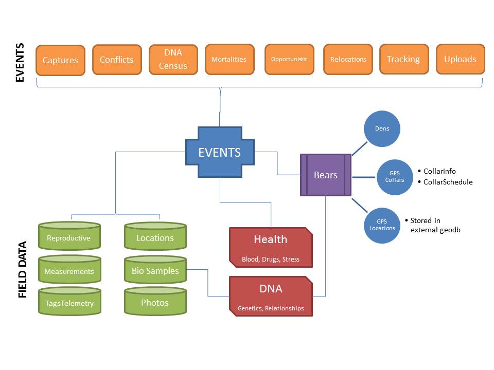
The Grizzly Bear Program has collected a wealth of data since 1999 and continually requires efficient data management. As the program continues to grow over the years, spatial and non-spatial datasets are continually evolving to meet research requirements. A centralized research database was created which enabled research biologists to process data and answer their research questions. The database was upgraded to handle the scale and scope of all the collected data, tools created to handle data imports, adn searchable forms to quickly access available data. Integration with GIS software allows for spatial mapping of the data at a click of a button.
When the Grizzly Bear Program first started collecting data in 1999, data was stored in various file formats and was difficult to manage. To address these data management issues, the design of a centralized database was created in 2000. This helped to minimize data duplication, allowed easy access and analysis, and established data collection protocols.
In 2008, a more robust database design was adopted by referencing one created by the Northern Divide Grizzly Bear Project in Montana. The new design was completed in 2011 and included the ability to link bear data with genetic information, initially stored in very complex spreadsheets. The upgraded database provides a much more efficient way to search out bear information from multiple sources.
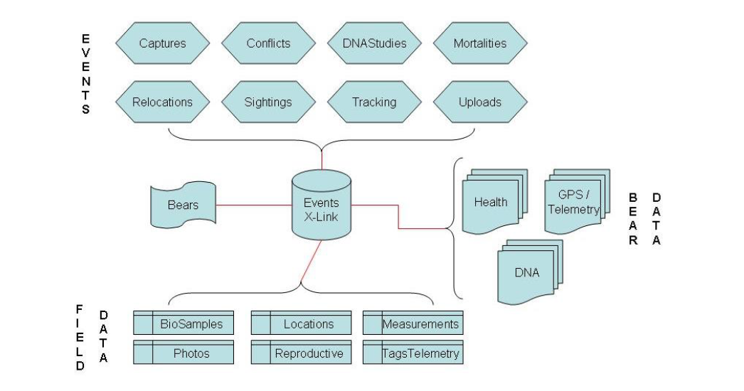
Many forms and tools are available within the Grizzly Bear Research Database. One such tool is the ability to find out the last time a particular bear was ever detected, whether by capture, from GPS collars or from being detected via a hair sample in a DNA census. Integration with our GIS software, allows the user to also create a map and a report of these locations.
Complete. The centralized database significantly improved overall data mgmt.
Complete: Tools created to enable researchers to process incoming telemetry data
Complete: Researchers now able to cross-reference bears with genetic info