Linkages between forestry practices, ungulate abundance, and the habitat use and performance of grizzly bear in and adjacent to woodland caribou habitat
This project will determine how forestry in west-central Alberta is affecting ungulate populations, including moose, elk, and deer. It will also investigate whether ungulate availability affects grizzly bear movement, behaviour, body condition and reproduction.
The second part of this project is to understand how grizzly bear’s respond to harvested and unharvested areas adjacent to caribou zones. We want to know how resource availability is influencing their movement and behaviour.
This project builds on 16 years of research conducted by the fRI Research Grizzly Bear Program in Alberta. Ultimately, this research will assist with the management, recovery, and long-term conservation of the grizzly bear where long term forest management is occurring. However, this research will also provide insights regarding the distribution and abundance of ungulate populations within a working landscape, and has broad applicability for management and conservation, particularly for areas that overlap with woodland caribou, a threatened species in Alberta. Specifically we will seek to ascertain how altering previous harvesting strategies in lands within and adjacent to caribou habitat where forest harvesting practices have been modified may have affected the habitat use, selection and movements of resident grizzly bears.
The aim of this work and ongoing commitment of the Grizzly Bear Program has been to provide Forest Management Agreement holders, government agencies and other stakeholders with a more complete understanding of grizzly bear habitat requirements within a managed landscape. This improved understanding will enable forest planners to further understand predator prey dynamics in the context of integrated land use planning.
Objectives
There are two broad goals:
- We will determine how forest harvesting in west-central Alberta influences the distribution and abundance of forest dwelling ungulate species (moose, elk, white-tailed and mule deer), and whether or not ungulate availability influences grizzly bear space use patterns and measures of performance (body length and mass, body condition, and reproduction). We will compare and contrast variation in ungulate availability and grizzly bear response at both local and regional levels.
- We will gain a better understanding of grizzly bear response to both intact (non-harvested) and harvested areas adjacent to caribou zones in relation to resource availability and movement patterns and behaviour.
We will use multiple sources of historic and new data collected within the Yellowhead and Grande Cache BMAs including aerial surveys of ungulates, biological information and GPS locations obtained from captured grizzly bears, and field investigations of grizzly bear predation or scavenging sites to meet the following research objectives:
- Develop predictive distribution and abundance models for four different species of forest dwelling ungulates (moose, elk, white-tailed and mule deer) to spatially represent ungulate availability at the landscape level and investigate potential relationships to forest states (i.e., age, species composition, configuration) and forest management activities (i.e., silviculture) associated with timber harvest.
Methodology: We will use winter aerial survey count data for four species of ungulates (moose, elk, white-tailed and mule deer) provided by GOA along with spatial depictions of underlying habitat conditions derived from remote sensing (landcover), vegetation inventories (AVI), and other sources (i.e., stream, topography, geology) to estimate regression coefficients that explain variation in the distribution and abundance of ungulates. Based on a series of a priori models, we will a model selection procedure to show support for or against our candidate model set. The intent is to determine whether or not temporal (survey year) or spatial factors associated with local environmental conditions (e.g., geology, soils, vegetation, topography) or land use features (i.e., open pit coal mine, oil and gas infrastructure, roads) compared to variables describing the state of forests and forest management activities associated with timber harvest. Coefficients from regression models will then be used to map ungulates species distribution and abundance. We will then use pellet count surveys collected along bear movement and random paths as well as GPS clusters (objective 2) and random locations to validate our model. This modeling approach will be undertaken within the Grande Cache and Yellowhead BMAs and our findings will be compared and contrasted. - Identify probable grizzly bear predation or scavenging of ungulate species from field site investigations of GPS clusters in order to determine variation in ungulate species consumption by bears.
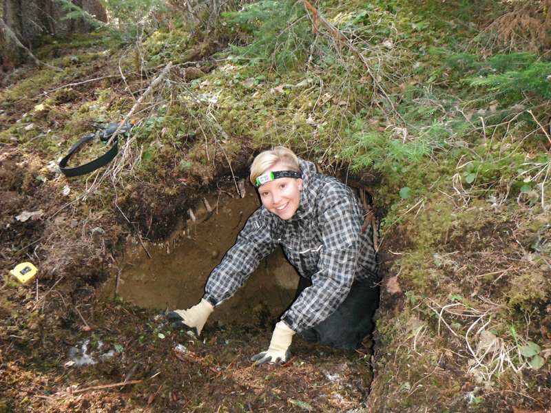
Methodology: We will capture grizzly bears within the Yellowhead (n=10) and Grande Cache (n=10) BMAs. Capture efforts will be focused within Weyerhaeuser’s FMAs (Drayton Valley, Grande Prairie) and along a gradient of industrial land use activities. From captured grizzly bears, we will obtain biological measurements (length, mass) to determine body condition and extract a pre-molar tooth for aging purposes. Addition biological samples (hair, blood, and tissue) will be obtained to support ongoing projects examining aspects of grizzly bear health and reproduction. We will also record the reproductive status of each female and identify the presence of cubs and estimate cub age. On a monthly basis, we will create clusters from GPS location data using the methodology developed for the Grande Cache study. We will stratify GPS clusters into classes according to time spent (number of GPS locations) and conduct field site investigations on a random sample of those clusters. Although we will aim to visit as many clusters as possible, emphasis will be placed on visiting clusters where time spent exceeds four hours because the likelihood of finding a probable predation or scavenging event increases with time spent. At each visited cluster, we will collect information on the bear’s activity (foraging, resting), identify any ungulate remains (bones, hair), and count ungulate species pellets. If the ungulate remains cannot be identified, we will collect hair samples for laboratory analysis. Assessment of the scale and medulla patterns of hairs will be used to identify species. - Develop a statistical model to determine which GPS locations are associated with probable predation or scavenging events and determine if variables representing forest states and forest management activities associated with timber harvest are important predictors.
Methodology: We will use field site investigations from historic data and data gathered from this project (objective 2) to build a model that assigns grizzly bear GPS locations as probable predation or scavenging events. First, we will identify predictors that describe the spatial pattern of the GPS locations and the temporal period involved. Second, we will generate other spatial and temporal predictors associated with the study animal (gender, age class, and reproductive status), local habitat conditions, and land use activities. Third, we will use a model selection procedure to determine whether the previous aforementioned factors to predict probable predation or scavenging events. More specifically, we will determine whether the forest state and forest management activities associated with timber harvest predict ungulate species consumption by grizzly bears. We will then use generalized linear model outputs to assign GPS data as probable predation or scavenging events to the entirety of our GPS location dataset, which will then be used to quantify the number of these events for each study animal. This approach will be duplicated for data sets collected in the Grande Cache and Yellowhead BMAs and the results will be compared and contrasted. - Assess the potential link between grizzly bear forest use patterns and ungulate species availability to measures of individual bear performance.
Methodology: We will use all available GPS location data collected within the Grande Cache and Yellowhead BMAs to estimate individual resource selection function models at the 2nd and 3rd orders (home range, within home range) using logistic regression in relation to ungulate availability. Depending on the results of objective 1, we will isolate ungulate availability predicted from forest state and forest management activities relative to other factors as potential predictors. This will allow us to determine if ungulate availability associated with forestry influences grizzly bear habitat selection. Model coefficients will then be used as our main predictors (forestry vs. other sources of variation attributed to ungulate availability) of explaining bear performance (length, mass, body condition, reproduction) along with other variables (control) that represent energy expenditure from locomotion (step length derived from GPS data), capture events, local environmental factors, land use, and biological factors (gender, age, reproductive status). We will use a model selection procedure to show support for or against our a priori candidate models, which will allow us to tease apart the influence of ungulates relative to other predictors on grizzly bear performance measures. We will contrast the results of our analysis between the Grande Cache and Yellowhead BMAs. - Assess the potential link between grizzly bear predation or scavenging events and ungulate species availability to measures of individual bear performance.
Metholdology: We will use all available data from field and GPS derived counts of probable predation or scavenging events collected, or estimated, for bears within the Grande Cache and Yellowhead BMAs. Counts of predation or scavenging for each bear will be used as our main predictors explaining bear performance (length, mass, body condition, reproduction) along with other variables (control) that represent energy expenditure from locomotion (step length derived from GPS data), capture events, local environmental factors, land use, and biological factors (gender, age, reproductive status). We will use a model selection procedure to show support for or against our a priori candidate models, which will allow us to tease apart the influence of ungulate consumption relative to other predictors on grizzly bear performance measures. - Determine habitat and resource use (including predation events) by grizzly bears in landscapes in and adjacent to caribou zones in the Kakwa region where forest harvesting strategies have been altered.
Methodology: We will attempt to capture and GPS radio collar up to 10 adult grizzly bears where home ranges are likely to overlap with both identified caribou zones and adjacent landscapes within the Kakwa region. These collars will last for the two year study and animal capture will only be required in the first year of this project. We will use our extensive historical research from this general region to increase our data set for analysis. New RSF models will be constructed using the newest GPS data sets from bears in 2016-2017 and these models will be compared and contrasted with existing RSF models generated from historic data from landscapes using “standard” harvesting strategies. Movement analysis from collared bears will also be compared with movement patterns from bears using habitats where modified forest harvesting practices have not occurred but are from the same ecosystem. Landscape condition mapping will be completed for 2016 and 2017 using the best available remote sensing imagery to ensure that movement and habitat use descriptors coincide with current landscape and forest conditions.
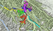
Study Area
The proposed project will occur within the Grande Cache and Yellowhead Grizzly Bear Management Areas (BMA). Several Forest Management Agreement areas occur within these units and include Canfor Corp., Millar Western Forest Products Ltd, West Fraser Timber Co. Ltd., and Weyerhaeuser NR Company.

Background
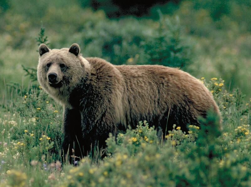
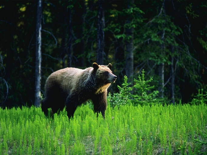
The grizzly bear (Ursus arctos) is listed as a Threatened species in Alberta due to lower than expected population size, limited dispersal from adjacent jurisdictions, and because of increased land use and human activity within grizzly bear range. Threats to the recovery and persistence of the population stem from uncontrolled human-caused mortality, particularly mortality events related to road access, and habitat alterations from industrial resource extraction activities. As a result, management actions to date have largely been focused on reducing grizzly bear mortality risk through the management of human use of access, specifically motorized vehicle routes, however, there has been little emphasis on maintaining or enhancing essential food resources.
Research in Alberta suggests that grizzly bear populations are influenced by both top down (mortality) and bottom up (food supply) factors. A recent study from west-central Alberta showed that after controlling for road density that is associated with grizzly bear mortality risk, local bear density is related to the availability of two key food resources – fruit and ungulates. It is therefore important to manage grizzly bear habitat in a way that minimizes human-caused mortality risk and at the same time maintains or enhances key food resources. This is particularly important for adult females given that even low levels of mortality can negatively influence population vital rates, and because females require sufficient fat reserves to successfully reproduce and rear offspring.
Disturbances from industrial land use activities associated with the energy (mining, oil and gas) and forestry sectors within Alberta’s working landscape have the potential to influence grizzly bear habitat quality. Although the management of these disturbances as cumulative effects should be considered when evaluating potential impacts to grizzly bear habitat, given that the majority of the anthropogenic footprint is associated with timber harvest, forest planning will to a large extent dictate the current and future habitat conditions for grizzly bears.
For this reason, research has focused on understanding how forestry practices may influence grizzly bear habitat conditions as a means to inform land use managers when making planning decisions. Research suggests that forestry cutblocks have the potential to enhance grizzly bear habitat due to an increase in seasonally available food resources. As a result, grizzly bears that use cutblocks tend to have higher indices of body condition and lower levels of stress (as measured by cortisol concentration levels in hair). However, the availability of food within cutblocks and their use by bears is dependent on a multitude of site and stand level factors that influence the distribution and abundance of vegetation.
Research has shown that important food resources such as fruit and ungulates may be associated with forestry cutblocks and that cutblock use by bears positively influences bear body condition. Information regarding food availability, particularly with regards to cutblock attributes, have largely focused on plants; no studies have examined the effect ungulates in a bear’s diet may have on measures of individual bear performance such as body condition or reproduction. Although grizzly bears are omnivores and exploit a wide array of energy rich foods, meat as a source of protein and fat is most easily processed into lean tissues or adipose fat stores compared with foods that are plant based. Grizzly bears with access to meat as a source of protein and fat tend to be large and large bears produce more offspring. Given that the health of individual grizzly bears and the size and growth potential of the grizzly bear population could be associated with certain ungulate species, understanding the potential linkages between forestry practices, ungulate distribution and abundance (availability), and grizzly bears may be an important component of habitat management that could influence recovery and long-term persistence of the population in Alberta.
In recent years forest harvesting activities in and around identified woodland caribou zones in west central Alberta have utilized modified harvesting strategies for a number of years while caribou recovery and range plans were being prepared. These revised harvesting strategies may have influenced grizzly bear habitat supply, food resources (especially ungulates) and movement patterns in areas where forest age structure and composition has undergone different rates of change. How grizzly bears have responded to these changes both inside and outside zones of modified forest harvesting and harvesting exclusion remains an unanswered question, but one that is germane for species at risk management and caribou recovery in Alberta.
Finally, understanding how anthropogenic disturbances influence wildlife populations is fundamental to achieving conservation and management objectives. With the recent advances in Geographical Information Systems and remote sensing, increasingly, predictive models of species distribution and abundance are being used in ecological research and as tools to make planning decisions in multiple use landscapes. These predictive models and associated maps are particularly useful for understanding habitat relationships for cryptic species with large area requirements that are often difficult to observe in the field such as the grizzly bear. In Alberta, resource selection function models and models of food distribution and abundance have been used with success to better understand what factors influence grizzly bears use of forested environments and the potential mechanisms explaining these patterns. Ultimately, the knowledge and tools generated from this research has aided managers with land use planning decisions surrounding industrial development in grizzly bear range, particularly with regards to the forest sector given the relatively large anthropogenic footprint associated with forest harvesting. Although management of grizzly bear habitat has been focused on reducing human-caused mortality risk associated with road access, recently, there has been an emphasis on resources such as food. A recent study in west-central Alberta suggests that key foods (fruit, ungulates) explains local patterns of grizzly bear abundance as measured from DNA hair snags. Whereas patterns in fruit availability have linked to forest management activities, it is not known to what degree forest state such as the age, size, and configuration of cutblocks relative to the matrix (uncut forest) as well as management activities related to silviculture (i.e., site prep, retention) influences ungulate species distribution and abundance. Because GOA conducts annual ungulate surveys to estimate density and set hunting quotas, there is an opportunity to use this information to create spatio-temporal models of ungulate species distribution/abundance, which have been developed in other areas of North America.
Determining how animals exploit resources such as food is fundamental not only to gain insights into the ecology of species, but is also an important component of habitat management. Although this can be challenging for a generalist omnivore like the grizzly bear that exploits a wide array of seasonally available food resources, a recent study in west-central Alberta showed that despite the generalist foraging behaviour of grizzly bears, the availability of two high energy food items (fruit, meat) explains local patterns of bear density. Whereas it is generally well understood how grizzly bears exploit plant-based foods such as fruit, it is not as well known how grizzly bears exploit different ungulate species. This objective builds upon an ongoing fRI Research project aimed at determining the role of the grizzly bear as a predatory of caribou in the Grande Cache BMA (a FRIAA funded project from 2014-2015).
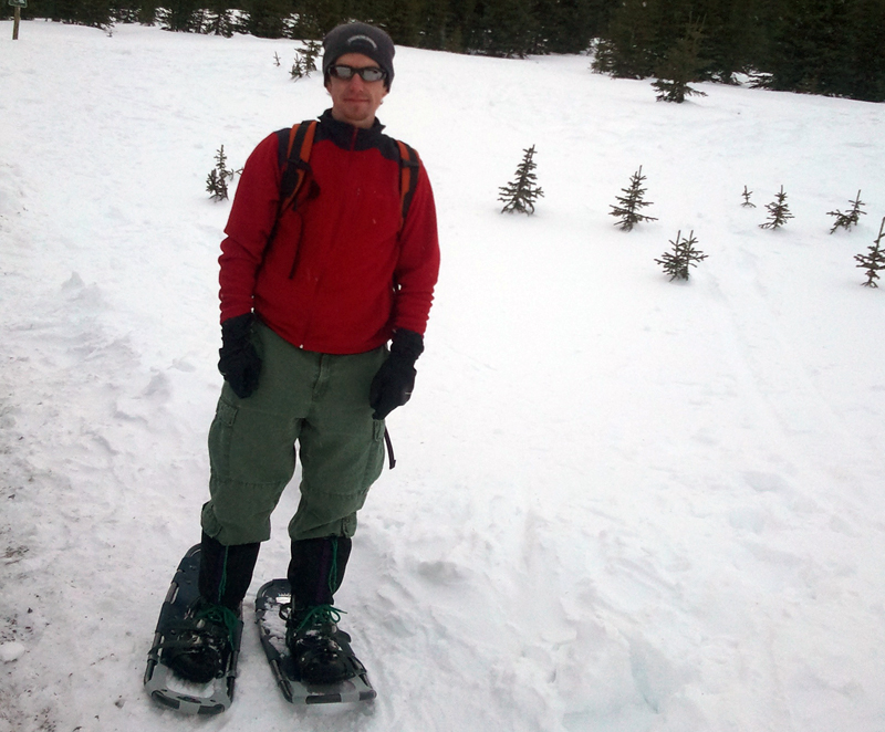
Teams begin collaring grizzly bears
Field crew begins visiting “cluster sites”where collared bears spend >4 hours