Article published in Forest Ecology and Management. Citation and abstract only.
Abstract
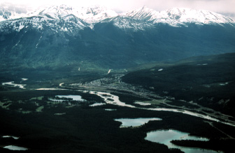
Researchers and managers undertaking wildlife habitat assessments commonly require spatially explicit environmental map layers such as those derived from forest inventory and remote sensing. However, end users of geospatial products must often make choices regarding the source and level of detail required for characterizing habitat elements, with few published resources available for guidance. We appraised three environmental data sources that represent options often available to researchers and managers in wildlife ecological studies: (i) a pre-existing forest inventory; (ii) a general-purpose, single-attribute remote sensing land cover map; and (iii) a specific-purpose, multi-attribute remote sensing database. The three information sources were evaluated with two complementary analyses: the first designed to appraise levels of map quality (assessed on the basis of accuracy, vagueness, completion, consistency, level of measurement, and detail) and the second designed to assess their relative capacity to explain patterns of grizzly bear (Ursus arctos) telemetry locations across a 100,000-km2 study area in west-central Alberta, Canada. We found the forest inventory database to be reasonably functional in its ability to support resource selection analysis in regions where coverage was available, but overall, the data suffered from quality issues related to completeness accuracy, and consistency. The general-purpose remote sensing land cover product ranked higher in terms of overall map quality, but demonstrated a lower capacity for explaining observed patterns of grizzly bear habitat use. We found the best results using the specific-purpose, multi-attribute remote sensing database, and recommend that similar information sources be used as the foundation for wildlife habitat studies whenever possible, particularly those involving large areas that span jurisdictional boundaries.
Read the full article here.
Citation
McDermid, G. J., Hall, R. J., Sanchez-Azofeifa, G. A., Franklin, S. E., Stenhouse, G. B., Kobliuk, T., & LeDrew, E. F. (2009). Remote sensing and forest inventory for wildlife habitat assessment. Forest Ecology and Management, 257(11), 2262–2269. doi:10.1016/j.foreco.2009.03.005