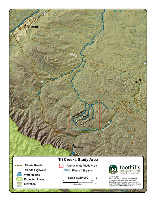
Our GIS Program is currently supporting researchers with the Water Program in the Tri-Creeks study area by assisting with spatial data management, reference mapping and habitat modelling. The Tri-Creeks study are includes Wampus, Deerlick and Eunice Creeks within the McLeod River watershed South of Hinton Alberta.
The goal of the project is to produce a hydrologic model for various scenarios such as mountain pine beetle forest kill, climate change and forest harvest. The watershed model will help researchers gain a better understanding of how streamflow responds to those different scenarios.
Gallery