By Cameron Naficy and Sarah Nason
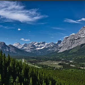
One of the main goals of the Landscapes in Motion Fire Regime team is to reconstruct forest fire dynamics of Alberta’s Southern Rockies using evidence from tree ring samples. After two years of field sampling, lab work, and analyzing and interpreting the data, Fire Regime researcher Dr. Cameron Naficy has started to see the fruits of his labour. He and his team have learned that the lodgepole pine forests of Alberta’s Southern Rockies were more resilient to frequent burning and more structurally complex than previously thought. In this post, we share more about Dr. Naficy’s findings and what the implications might be for managing Alberta’s forests.
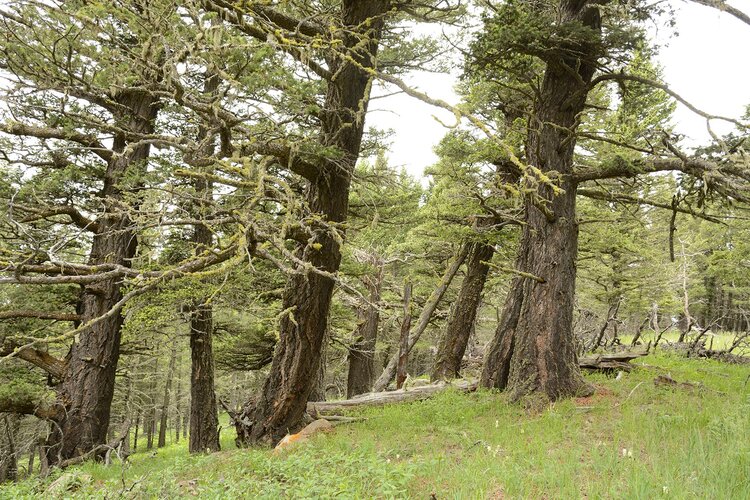
Researchers traditionally believed that fires in Southern Alberta were quite severe and relatively infrequent, occurring every 60-200 years or so[1],[2],[3]. Long fire-free periods were thought to have been important to allow the forest to recover following intense fires. Recent research has begun to question how resilient lodgepole pine forests, such as those in the Alberta Foothills, may be in the future if fire frequencies increase as a result of climate change.
Recent findings from fire regime researcher Dr. Cameron Naficy suggest that the forests of southwestern Alberta’s Foothills can offer many insights into this critical question. By studying tree rings in Alberta’s Southern Foothills, Dr. Naficy has learned that fires in the lodgepole pine forests of this region were more frequent, burned in more complex patterns, and were more resilient than the research community previously thought. Indigenous cultural fire practices that increased fire frequencies in this landscape likely contributed to these patterns. As a result, the Alberta Foothills may serve as a prime case study where researchers can examine forest resilience to frequent fire and directly test predictions from existing climate change models.
The importance of understanding Alberta’s fire history
So, where did researchers’ knowledge about lodgepole pine forest fires come from, and how is our research challenging what we thought we knew? To answer the first question, researchers turned to the past, using tree rings and historical imagery to document the history of fire’s effects on the landscape. To explore the answers to the second question, we first need to understand what fire severity means.
Severity helps researchers to understand how much the fire has affected the ecosystem. It is generally defined as the percentage of trees that are killed in a fire. Fire severity is therefore a spectrum. On one end of the spectrum, a low severity fire mostly consumes understory vegetation and leaves most trees alive. On the other end, high severity fires typically kill most trees and other vegetation.
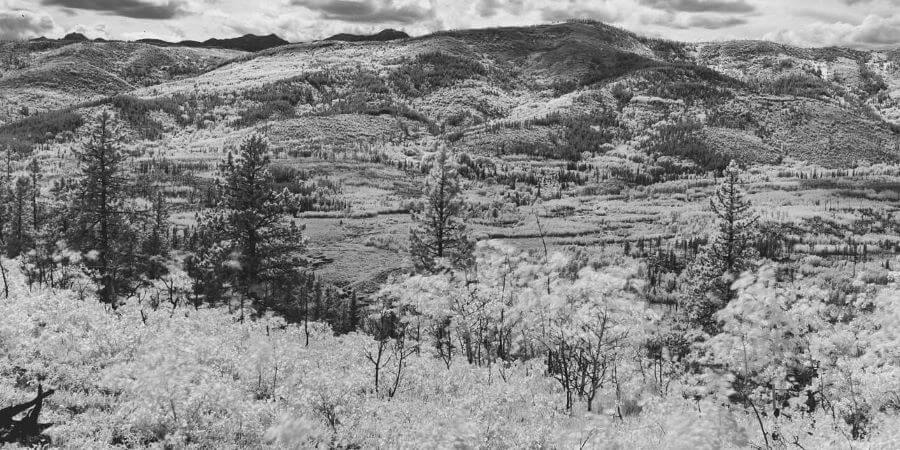
The Chimney Rock Fire burned through a portion of our study area in October of 2017. Even over short distances, note the range and pattern of fire severity it produced, including unburned forest, lightly underburned stands, and areas of severe underburn or complete crown consumption that killed overstory trees.
When researchers look at severity at a landscape level over long time periods, the story gets complicated. Just because an area has a high severity fire one year doesn’t mean it will have the same severity of fire the next time it burns. By examining the patterns of burn severities over time for different points in the landscape, researchers can define the fire regime of an area. For example, an area might have fires every 50 years that vary from low to moderate severity – this would be called a “non-stand replacing regime.”
Why is it important to understand fire regimes? Importantly, knowledge about fire regimes can help protect communities. When communities know what severity and frequency of fire to expect in a region, they can better plan for future fires, estimate the risks that wildfire poses to communities, and evaluate the potential effectiveness of different fuel management strategies.
Studying historical fire regimes can also help forest and land managers understand if fire regimes are changing as a result of past land management or climate change and can provide a guide for mimicking natural disturbances. For example, this information could help support harvest planning aimed at replicating the natural fire patterns in a given region.
And if you are a researcher like those on our team, or a member of the community in the area, you are also probably just curious about the history of the land: the history of your home.

Updating our understanding
Based on the best available science, researchers have long thought that lodgepole pine forests across the West burn infrequently, but intensely, mostly during severe drought years. The role of fuels in regulating fires in these forests has been debated, but is based on a well-established general relationship between fire severity and frequency: the longer the time between fires, the more severe the next fire tends to be. This is because materials that can burn – dead trees, fallen branches, and growing vegetation – tend to build up more and more in the forest during the time between fires[4]. Although climate is thought to have primarily driven wildfire activity for subalpine forests in southwestern Alberta, this question has not been examined in lower elevation montane forests, where fires were more frequent.
The LIM Fire Regime team’s research suggests this general relationship between fire frequency and severity exists in the montane zone of lodgepole pine forest in our study area. However, the research team’s findings also show this relationship is not always so cut-and-dry: across the broad area sampled by our team, there was a complex relationship between fire frequency and fire severity. As a result, future fire patterns are more challenging to forecast in this area than might be expected, and our team needed a lot of high-quality data to be able to make reliable predictions.

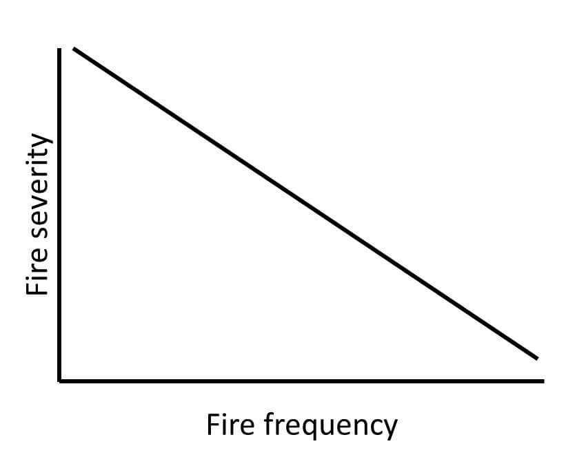

The lefthand graph shows the general relationship between fire severity and frequency that we found in our study. This relationship differs from the case where fire severity and frequency are linearly related (middle), or a more traditional assumption for this area that there is no relationship between fire frequency and severity (right).
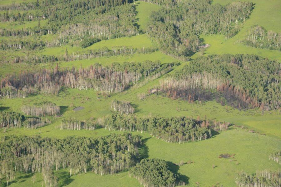
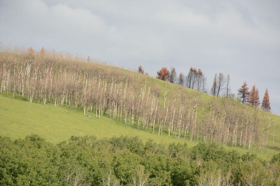
Based on data collected from hundreds of plots throughout the Foothills, the team found that high severity fires were most common, even when fires were frequent. However, as fire became more frequent, the fire regime began to diversify: it shifted to include more of a mix between low, moderate, and high severities. This diversity in fires, in turn, produced a diverse landscape with a mix of stand ages, structural types and patch sizes. Especially in the montane zone of the Foothills, our researchers found a diverse mosaic of severely burned and partially burned patches.
In addition, frequent fires favored expansion of aspen forests in areas that would, in the absence of fire, likely support lodgepole pine. This may help explain the abundance of aspen in the Foothills region.
These findings have important implications for the Foothills and our understanding of fire regimes and lodgepole pine forest resilience more broadly. They also highlight how Indigenous cultural fire practices that promoted increased fire frequency in the region have created a unique opportunity for researchers to study the mechanisms behind ecological resilience to frequent fire. Without the traditional burning practices of Indigenous peoples, fire in this landscape may have recurred at longer fire intervals, similar to lodgepole pine forests elsewhere, obscuring some of the most important discoveries uncovered by our team.
Changing knowledge, changing practices
The insights about forest resilience that we are learning through this project can help support environmentally responsible land management and inform how we think about and plan for climate change. Using knowledge of historic fire regimes, land managers can make decisions about how to manage fires in the future, how to apply management tools such as prescribed fire, or how to prioritize post-fire management activities.
Another important implication of our findings is that lodgepole pine forests in Alberta’s Foothills have the potential to adapt to increased fire frequency caused by climate warming. Through ongoing research in this region, we will continue to learn from this landscape and provide insights that inform our understanding of forest resilience and responses to climate change more broadly.
By understanding how and why fire regimes and landscape conditions have changed over time, our team’s hope is that we can all plan for a better future for the forests of Alberta’s Southern Rockies. By maintaining these forests on the landscape and taking care of them, we can make sure that the goods and services they provide us – space to recreate, abundant wildlife, food, timber, and so much more – continue to flourish.
Learn more about the Fire Regime team’s work
- Our latest findings (webinar by Dr. Naficy): Unraveling the Complexity of Mixed Severity Fire Regimes: New Insights From Three Rocky Mountain Ecosystems
- Evidence of historical cultural burns in Alberta’s Southern Foothills: Ignition Point: The Underappreciated Influence of Indigenous Burns
- Why we do what we do: Why study historical fire regimes and how do we do it?
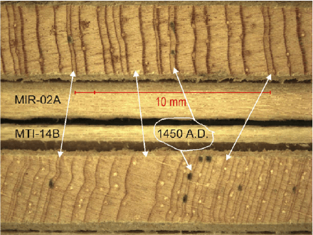
- How does the Fire Regime team learn about the landscape’s past? The truth is in the tree rings…if you crossdate them
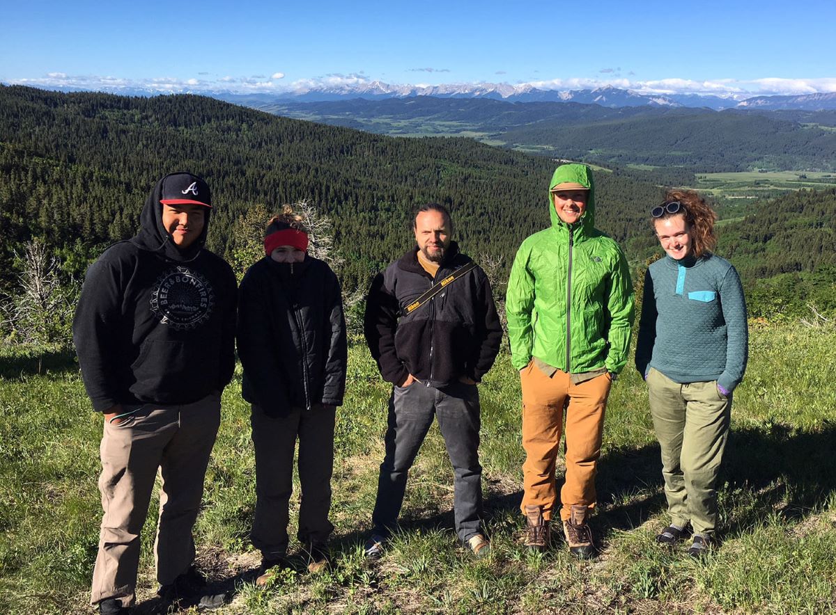
- What does our field work look like? Meet the Fire Regime Field Crew!
Every member of our team sees the world a little bit differently, which is one of the strengths of this project. Each blog posted to the Landscapes in Motion website represents the personal experiences, perspectives, and opinions of the author(s) and not of the team, project, or Healthy Landscapes Program.
Note:this post was updated November 18, 2019 to include image attribution to the Mountain Legacy Project.
[1] Johnson, E. A., & Larsen, C. P. S. (1991). Climatically induced change in fire frequency in the southern Canadian Rockies. Ecology, 72(1), 194-201.
[2] Johnson, E. A., & Fryer, G. I. (1987). Historical vegetation change in the Kananaskis Valley, Canadian Rockies. Canadian Journal of Botany, 65(5), 853-858.
[3] Wagner, C. E. V., Finney, M. A., & Heathcott, M. (2006). Historical fire cycles in the Canadian Rocky Mountain parks. Forest Science, 52(6), 704-717.
[4] Steel, Z.L., Safford, H.D., and Viers, J.H. (2015). The fire frequency-severity relationship and the legacy of fire suppression in California forests. Ecosphere 6(1): 8.