By Cameron Naficy and Sonya Odsen
Here at Landscapes in Motion, we talk a lot about “looking to the past” to understand how fire regimes have shaped the landscapes of the southern Rockies in Alberta. Unfortunately, we don’t have a time machine to go back there ourselves, but we have the next-best thing—clues left behind on the landscape itself. Cameron Naficy explains how the Fire Regime team collects and interprets these clues in order to reconstruct the fire regimes of the past.
One needs only to look at the news to see how fire events over the past several years have had huge impacts on communities that live, work, and recreate in forests. But why do we at Landscapes in Motion care so much about the fire regimes of the past?
At the heart of it, our reason is simple: the more we understand historical fire regimes, the better we can understand the fundamental causes and consequences of fire. In a time when global temperatures are rising and drought and extreme weather are expected to increase, this knowledge is certainly not trivial. Indeed, many temperate ecosystems—including the landscapes of southwestern Alberta—are expected to experience more frequent and severe wildfires as a result.
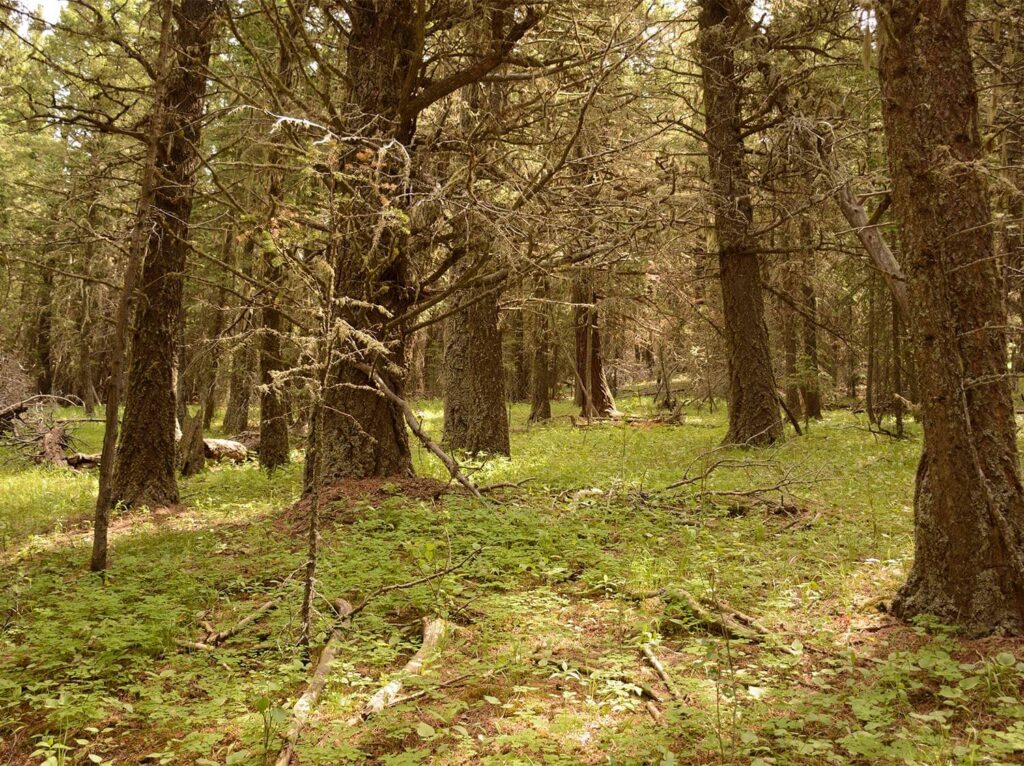
For the next several decades at least, one of our best opportunities to understand the complex dynamics of ecosystems with active fire regimes is by using historical data. We have learned, and are continuing to learn, a lot from modern wildfires—but there are some important limitations to what we can learn from the short record of modern wildfires that occurred within the last two decades. Unlike many forests today, historical landscapes with abundant fire activity burned under a variety of weather conditions and had more complex landscape patterns. After almost a century of fire exclusion, much of this landscape diversity has been lost and we continue to extinguish all but the most extreme wildfires. As a result, the patterns and processes that we observe in recent fires may not reflect how our landscapes are likely to look under projected increases in fire activity.
Our interest in studying the past comes from the rich information contained in historical landscapes and the unique ecological knowledge that we can gain by studying them. Ironically, looking into the past through studies of historical landscapes may be one of the best ways to glimpse into the future.


How does fire shape forests and landscapes?
The frequency and severity of fire are two key elements that define an ecosystem’s fire regime.
Fire frequency
Fire frequency is a measure of how often fires occurred in a landscape. We normally measure this as the average time between fires, and the variability in the time between fires. For example, some ecosystems burn every 25 years on average, while others burn every 200 years or more.
Fire frequency and variability are important because many ecosystem properties—the mix of tree species, tree ages, and abundances of different types of fuels, to name a few—change over time as an area recovers from fire. These changes affect many ecosystem characteristics including wildlife habitat, soil properties, water cycling, and even the probability of the ecosystem burning again.
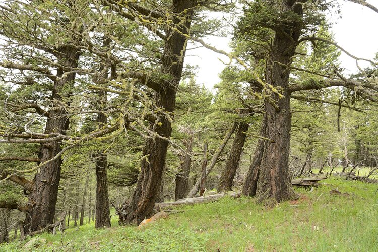
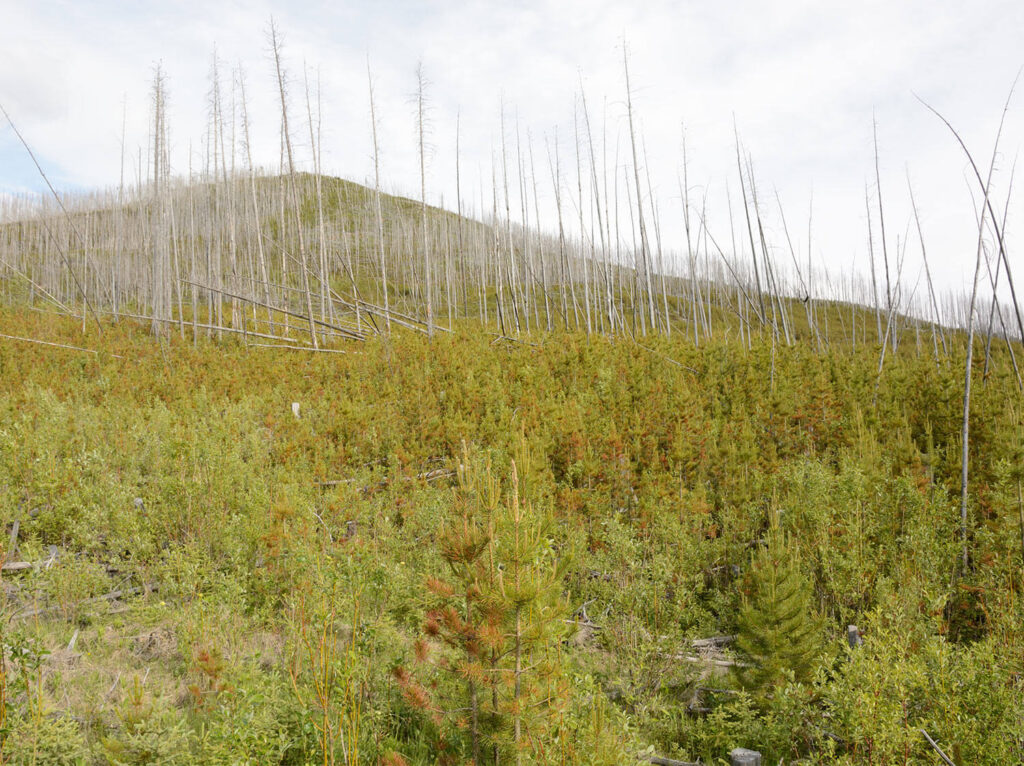
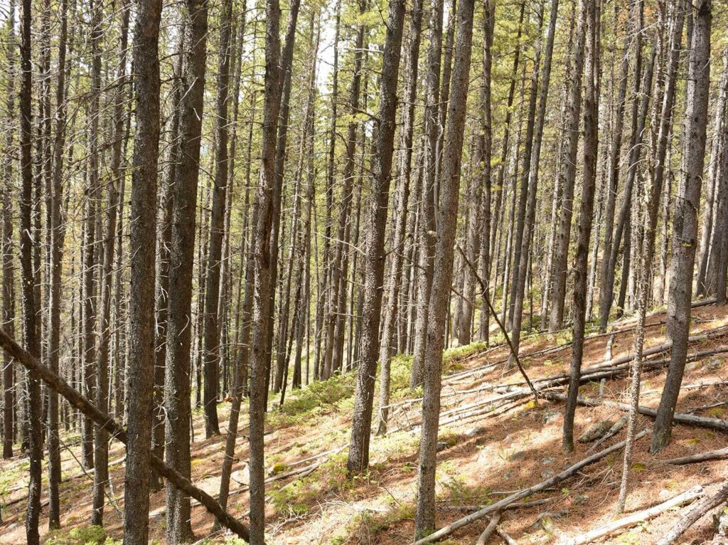
How does one fire affect the probability of the next fire? Imagine three different ecosystems: one is recently burned, leaving it exposed to the sun, and it is dominated by patchy regenerating shrubs, grasses, and tree seedlings. Another is a dense forest that hasn’t burned for 100 years. The last ecosystem burned centuries ago—it is multi-layered, and its understory is cool, moist, and sparsely vegetated. These forests have different fuel and microclimate conditions that have developed since the last fire. These differences would influence the probability of a fire occurring, the weather conditions (e.g., drought, wind, etc.) required to sustain a large fire, and the fire’s behaviour (e.g. how intense) when it does occur. Each of these forests has the potential to burn—but this potential is not equal.
Fire severity
While fire frequency tells us how often fires occurred, fire severity tells us how much the fire has caused the ecosystem to change. In forest ecology, we often define severity as the percentage of trees that were killed by fire.
This information is a critical companion to information on fire frequency: the effects of a low-, intermediate-, or high-severity fire may have very different and long-lasting impacts on the vegetation characteristics, ecological functions, and future fire activity of an ecosystem.
Let’s imagine some different ecosystems again, this time in terms of the conditions created by fire. One experienced a low-severity fire that burned up most of the vegetation on the forest floor and killed some smaller trees but left most of the overstory trees alive. The other experienced a high-severity fire that completely consumed all living trees, regardless of size or age. The ecosystem functions, ecological processes, and human values associated with each of these scenarios will clearly be very different.
A complex relationship
Fire frequency may affect severity, and severity may affect frequency, but the relationships between these characteristics are complex. If we are to understand these complex relationships and the fire regimes that result from them, it is important that we examine each one directly, using independent data sources. Here’s how we are doing this through the Landscapes in Motion project.
Historical data: our window to the past
Unfortunately, there is no single data source that provides the whole picture. Instead, different data sources provide different pieces of the puzzle. These include historical survey data, dendroecological data (the study of tree rings), and historical aerial or land survey photographs.
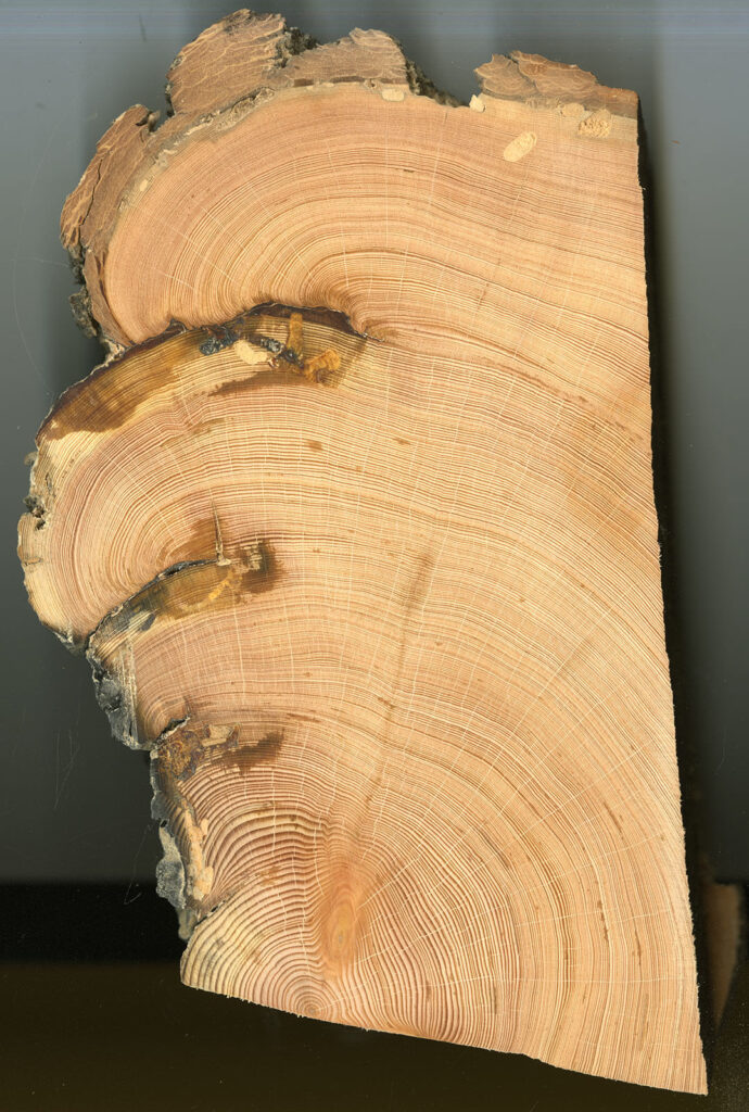
Dendroecological data—information collected from samples of tree rings can provide very detailed information of when and where fires occurred over hundreds of years. By examining statistical patterns contained in growth rings and documenting the years when fire scars were formed, we obtain very precise information about when and where past fires occurred. We can also use the records of tree ages found in tree ring samples to understand how many trees survived or established following a fire event. This provides us with an estimate of fire severity for each site that we sample in a landscape.
However, this work is also very time-consuming, resource-intensive, and analytically challenging. As a result, detailed dendroecological studies are often limited to small portions of a landscape.
Aerial photographs, in contrast, can provide detailed information about the patterns (e.g., vegetation conditions) created by fire, which we can use to make inferences about the patterns of fire severity over very large areas. But it is not possible to know the history of fire frequency and severity that created these patterns from the photos directly, so some kind of field data is needed to help us confirm these interpretations.
The practical reality with historical data sources is that they all have limitations, and these limitations can present problems when we try to interpret the data.

So how do we do it?
To confront the challenge of reconstructing fire regimes in historical landscapes, we are combining these data sources to get a more complete picture. In essence, we try to take advantage of the different strengths of each method to fill in gaps left by the other. In this project, we are combining dendroecological data with high-resolution historical aerial photographs, in an effort to understand fire frequency, severity and the resulting landscape conditions that existed over a broad region in southwestern Alberta.
Aerial photographs allow us to map the characteristics of vegetation patches that existed on the landscape as early as the 1940s, a time when fire exclusion was just beginning in southwestern Alberta. Dendroecological data allows us to collect precise fire frequency and severity information within a portion of these patches, which in turn helps us interpret the aerial photographs with more confidence.
Uncertainty is inevitable when studying ecosystems, particularly when trying to understand processes that occur on very large scales with incomplete evidence. By taking advantage of the various tools at our disposal, we don’t eliminate this uncertainty entirely, but we do chip away at it significantly.
Learning from history
At first glance, it might not be obvious why our researchers are so interested in understanding fires that burned a hundred years ago or more. Here at Landscapes in Motion, we might seem a bit obsessed with the past—but that’s because we know that by understanding the past, we are creating a clearer window into the future.
Cameron Naficy is a Post-Doctoral Scientist in the Tree-Ring Lab at the University of British Columbia and a member of the Fire Regime Team of Landscapes in Motion.
Sonya Odsen is an Ecologist and Science Communicator with a background in boreal ecology and conservation. She is a regular writer for Landscapes in Motion and is part of the Outreach and Engagement Team for the project.
Every member of our team sees the world a little bit differently, which is one of the strengths of this project. Each blog posted to the Landscapes in Motion website represents the personal experiences, perspectives, and opinions of the author(s) and not of the team, project, or Healthy Landscapes Program.