By Sonya Odsen and Ceres Barros
Landscapes in Motion is a project to improve the understanding of how, where, and when wildfires have occurred through Alberta’s southern Rocky Mountains. In this piece we enter a sophisticated landscape simulation with the Modelling team and watch how landscapes and biodiversity respond to fire when we take partial mortality into account.
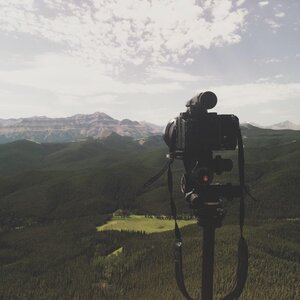
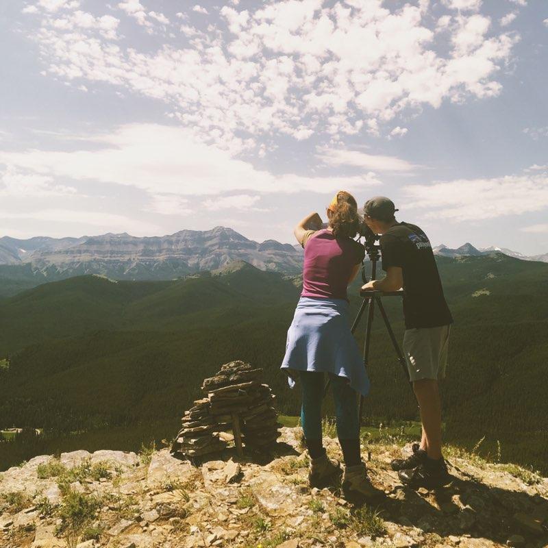
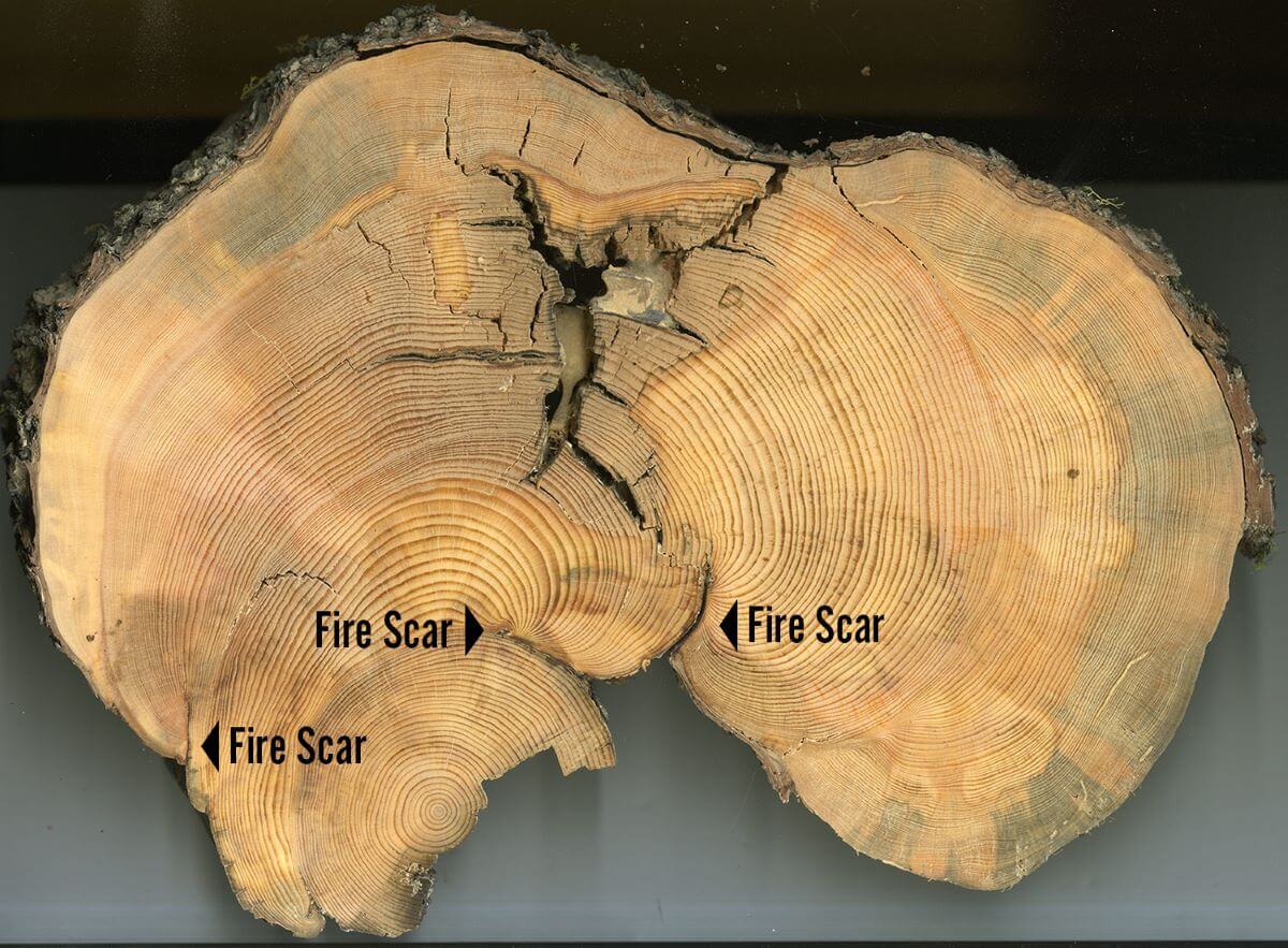
There are many different ways to look at the landscapes and forests of Alberta’s Foothills. We can get up close to individual trees, measuring their age from tree cores and their history from scars left by fire. We can look out to the horizon from mountain peaks—or use archived photographs to see what historical surveyors saw from the same viewpoint.
We can also look at the landscape as a model—or a series of data points describing the huge range of variables that affect a forest, including tree growth and death, fire ignitions and severity, climate and topography, and how these variables interact with each other over time. This has been the work of Dr. Ceres Barros and Dr. Eliot McIntire of the Modelling team.
Models like the one they have developed are powerful tools for both research and decision-making. This is particularly important in ecosystems like Alberta’s Eastern Slopes, where many different ecological and human values hang in the balance. Many modern landscape management approaches use historical processes and patterns as a template to help establish management directions, which means that having the most accurate models possible is key.
Striving for realism in our models
There are many different relationships between fire, vegetation, climate and topography. These relationships are described as “feedbacks” because each one drives another—for example, climate and topography affect fire severity (mortality), which affects fuel loads and the kind of forest that grows back, which affect the severity of the next fire, and so on. In landscapes as diverse as Alberta’s Foothills, taking these feedbacks into account is of utmost importance in order to better understand how the landscape grows, burns and changes over time.
To this end, Landscapes in Motion’s Modelling Team has built a model of fire spread and vegetation dynamics that accounts for partial mortality (along with topography and climate). This allows the team to explore potential feedbacks between different versions of fire regimes (e.g., high-severity versus mixed severity) and vegetation within the LIM study area.
Ultimately, the Modelling team is in pursuit of a more realistic model of landscape dynamics in southwestern Alberta. As models become more realistic, decision-makers are able to make better-informed decisions, and researchers are better able to explore past and future dynamics.
A tale of two models
Ecological models are a representation of reality. They help us better understand how ecosystems work, ultimately allowing us to make better decisions around how we manage or impact them. They are also a simplified representation of reality, as ecosystems are infinitely complex, and computers (and humans) can only make sense of so many pieces at once.
This means that every model is built using what we hope are the most important variables, such as tree biomass, weather and fuel conditions. More complex models may also include other models nested within them—for example, the Modelling team used an existing model [1] to predict fire ignitions across the study area based on fuel conditions and weather.
Every modeler is faced, therefore, with important decisions about which variables and models to include and why. As our other Landscapes in Motion teams have found, in the case of southwest Alberta this question often boils down to: what kind of fire regime has historically shaped the landscape?
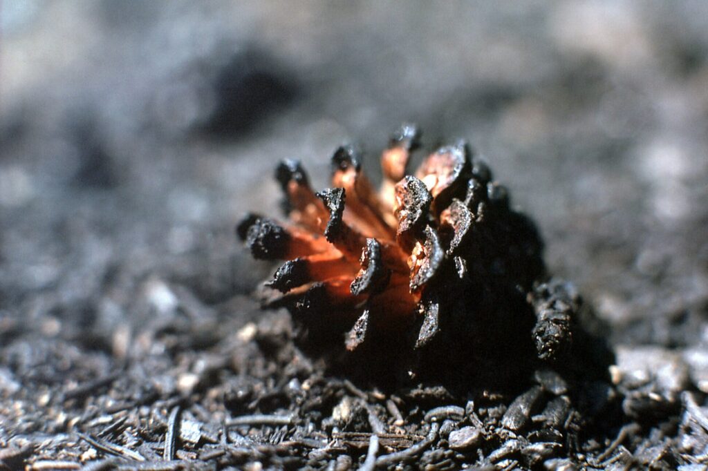
In the context of models, this question is represented by assumptions around mortality. If we assume stand-replacing fires, that means that every tree that burns in the model dies. If we assume that tree mortality can vary (i.e., partial mortality), it means that a tree that burns may survive, depending on its age, whether it is a fire-tolerant species, and the severity of the fire. Likewise, regeneration depends on fire severity: for example, if a fire does not burn very hot, fewer lodgepole pine cones may open, and trees other than lodgepole pine may grow back instead.
The Modelling team created a set of simulations to see how these variables and assumptions interact to shape the landscape (the LIM study area) over time. They started with a baseline landscape using existing climate data and landcover data representing landscape conditions of the late 20th century, then simulated how trees grow, reproduce and die, and how many fires start and how they spread, each year for 100 years. This means that each year, trees in different pixels of the simulated landscape age, die, reproduce, burn or regenerate, and these processes depend on 1) what happened in the years before (e.g., did a fire kill half the trees) and 2) what is happening in the pixels around them (e.g., is there a fire spreading from next door or are there seeds coming in).
The key difference in the simulations was the assumption of stand-replacing fires versus partial mortality, and what we learn from them is how do these two different fire regimes shape these landscapes?
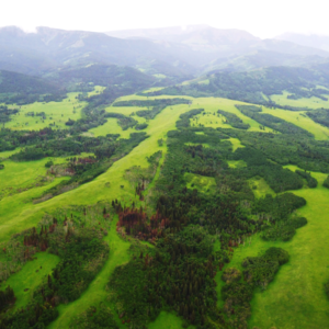
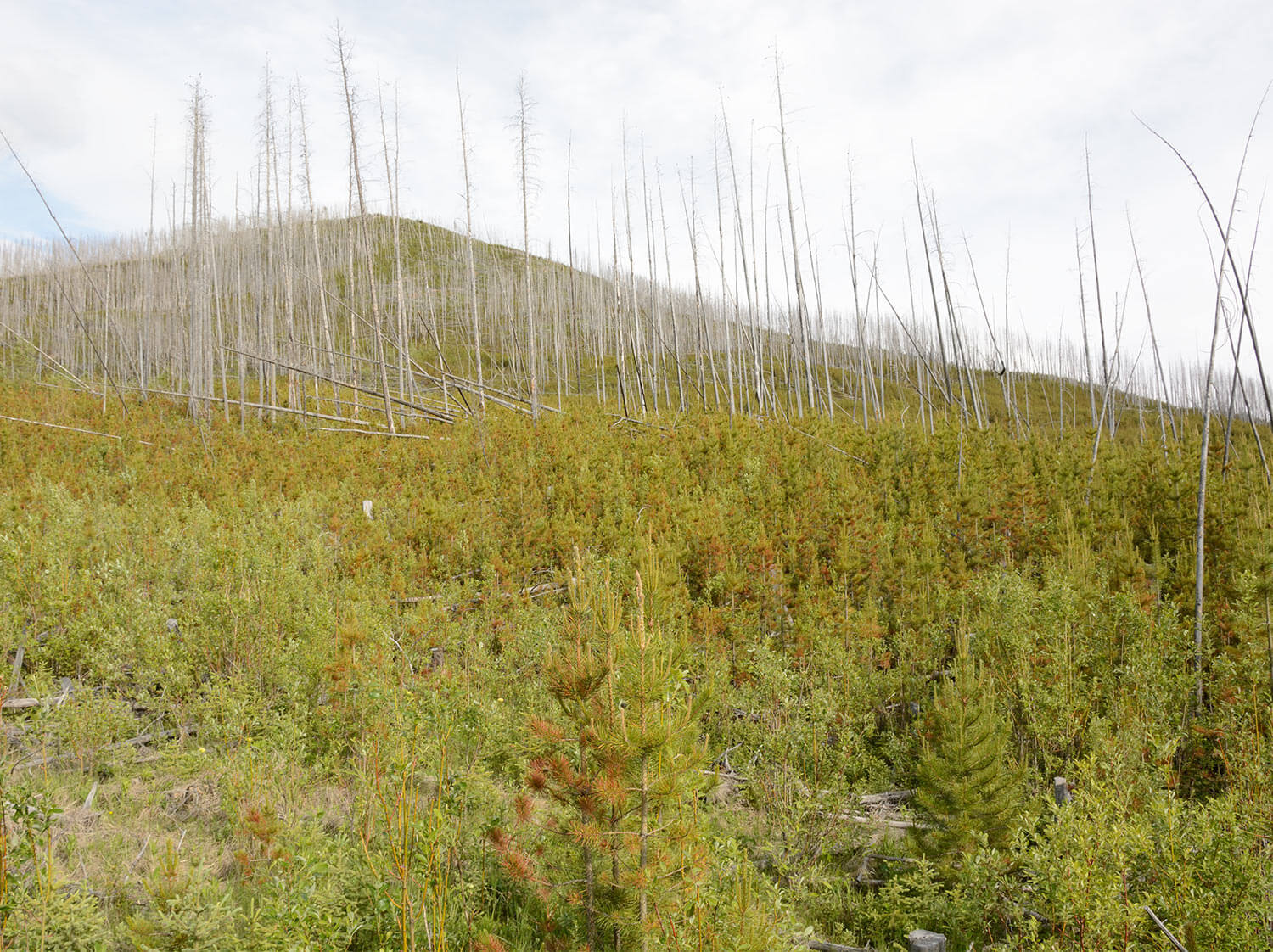
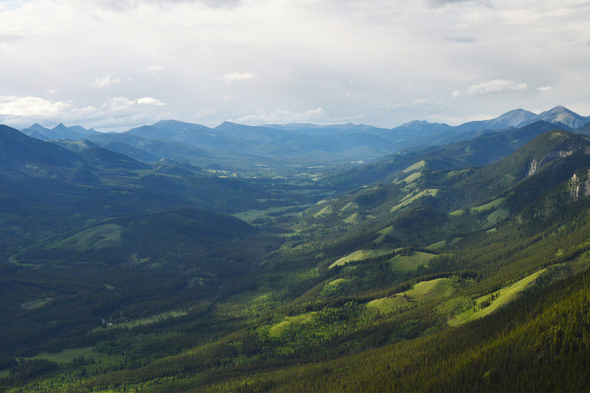
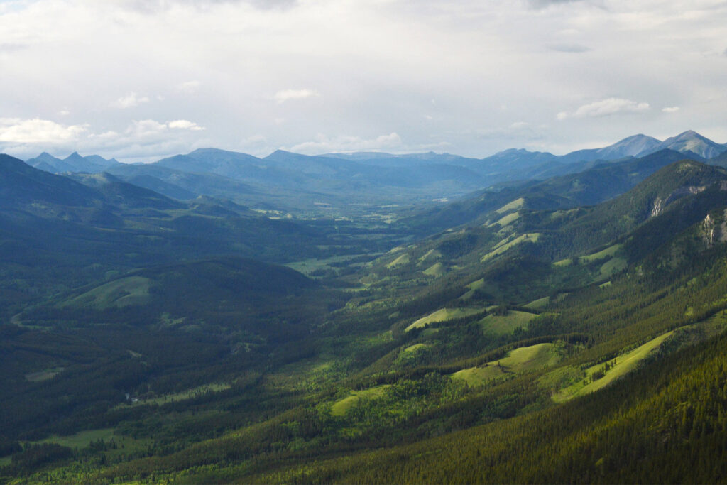
Left: Evidence of partial mortality in the patchiness of the landscape. The forest in the bottom-left corner is re-establishing after a recent fire that only burned some patches of trees. Photo by Ceres Barros.
Right: A burned lodgepole pine cone. Photo by Don Despain, U.S. National Park Service (1976).
Partial (fire) mortality leads to higher landscape biodiversity
The simulation that accounted for partial mortality of burned forests led to landscapes that were patchier, had a more even representation of forest types, and had many more old forest stands.
Let’s think about the simulation as a grid of pixels, where each pixel represents an area on the ground. In the simulation that assumed stand-replacing fires, Douglas-fir and fir species tended to decrease on pixels that burned, while pine, deciduous and spruce species either increased or remained steady on the landscape. Over the course of 100 years, the landscape became more uniformly dominated by pine species (and white spruce at higher elevations). Engelmann spruce, fir and Douglas-fir forests, in contrast, declined or were lost across much of the landscape.
This creates a strong contrast with the simulation that accounted for partial mortality. When tree, fuel and fire conditions determined the likelihood of trees surviving a fire, suddenly Douglas-fir trees became frequent survivors. Compared with the stand-replacing simulation, more Douglas-fir forests survived to older ages, which has important implications for the species that rely on these forests and for old-growth features like large-diameter trees and snags. Additionally, pixels that burned had higher stand-level diversity compared with those that did not, suggesting that wildfire (specifically, low- to moderate-severity fires) was an important driver of stand-level biodiversity.
Across the landscape in the partial mortality simulation, more stands were dominated by species other than pine (e.g., white spruce and Douglas-fir) and by older trees. Rather than being uniform and dominated by one or two species, these landscapes were more biodiverse; this difference could have important implications for wildlife, resilience, and more.
So which model is more realistic?
To answer this question, the Modelling team compared the simulated forest age data with the results of the Fire Regime team’s dendroecological results (forest ages according to tree-ring analysis). Accounting for partial mortality led to smaller differences between simulated and observed ages across forest cover types—i.e., it created a more realistic model for the LIM study area. The model that accounted for partial mortality was more consistent with observed ages of Douglas-fir, spruce, mixed and dry conifer-Douglas-fir forests compared with the stand-replacing model. While exciting from a scientific standpoint, this also suggests that this model would be more useful for management because it is more accurate than the stand-replacing model.
What does it all mean?
The results of these two simulations have important implications for how we understand the landscape dynamics of southwest Alberta. While the models did not include wildlife biodiversity or assess forest resilience, we can form some hypotheses based on well-established relationships between these factors and heterogeneous (patchy and diverse) landscapes.
Heterogenous landscapes like the ones produced by the partial mortality model are often linked to higher wildlife biodiversity because they provide a wide range of habitats that different species need. Many different bird species, for example, rely on old-growth features like snags, or recent burns, or shrubby patch edges, or mixedwood forests [2]—all of these habitats are better represented in the partial mortality model. Spruce-dominated stands, which were more common in the partial mortality model, are important habitat for Grizzly bears [3]. Having more old-growth forests has important implications for caribou, who rely on old conifer forests [4].
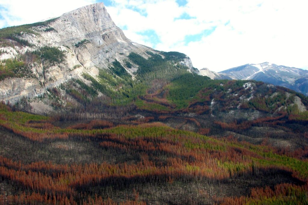
Heterogeneous landscapes also present an important contrast to large, uniform, (often pine-dominated) forests when it comes to resiliency to disturbances. In western Canada, large, even-aged pine stands have been particularly vulnerable to mountain pine beetle outbreaks and massive wildfires, one often following the other. Without breaks in the forest caused by patches of other species (like aspen or Douglas fir) or other land cover types (like grassy meadows), these disturbances are able to spread rapidly, with devastating consequences for forests and the people who rely on them.
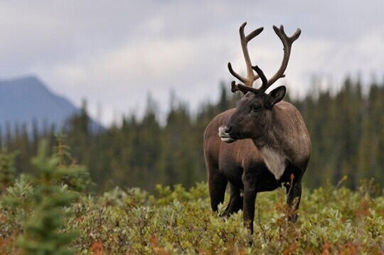
Left: Older forests are important habitat for many species, including the nationally Threatened woodland caribou.
Right: Forests affected by both wildfire and mountain pine beetle die-off. Photo by Crisia Tabacaru, courtesy of fRI Research.
What does it mean for management?
The forest management community has, by and large, adopted many principles of Ecosystem-based Management and Natural Range of Variation. These strategies involve looking at historical disturbance processes and emulating them in the way we manage forests, with the underlying assumption that (for example) harvest patterns that resemble fire patterns will have a better chance of supporting healthy ecosystems.
This means that our understanding of natural disturbance processes directly influences the way that we manage forests, and the kinds of forests that result. The findings presented here suggest that in southwest Alberta, disturbances that have variable severity will lead to very different landscapes than stand-replacing disturbances.
The positive effect of fire frequency on stand- and landscape-level diversity also has possible implications for how we approach prescribed burning. In areas where wildfire is suppressed to protect human homes and livelihoods, there may be benefits to increasing planned burns—including supporting the revival of cultural burning practices by Indigenous communities.
What comes next?
There are many exciting directions that we can move forward with the Modelling team’s work. Indeed, some of these next steps are planned or even underway.
Incorporating additional data
A model is only as good as the data that goes into it. While the Modelling team drew on well-established variables and models to build their simulations, they have identified ways to add further realism to their models by including more on-the-ground data.
Observed fire severity data
An important step that is already in progress is to incorporate spatially-explicit fire severity data collected by the Fire Regime team and data from outside the LIM study area. In the current model, fire severity was determined using a widely used fire behaviour prediction model, which has been thoroughly tested and is solidly supported. However, the Modelling team ultimately wants to draw from observed data as much as possible. They are currently working with Dr. Cameron Naficy of the Fire Regime team to develop a model that relates fire severity with time since fire, severity of the previous fire, and other potential variables like drought index.
Historical fire ignitions and frequency
The current models used fire ignition data from 1961–90, but pre-industrial fire ignition patterns may have been different, and pre-industrial fire records may be more appropriate. (However, the fire frequencies produced by the model were in line with what the Fire Regime team found, suggesting the model was not far off!) An important next step will be to incorporate the pre-industrial fire occurrence data collected by the Fire Regime team and see how this affects the model.
Fire spread and persistence
Fire spread (how a fire moves across the landscape) and persistence (how long it burns) were made conditional on fire behaviour properties in the model because of a lack of data within the study area. To draw from real-world data, future steps may include incorporating data from similar ecosystems outside of the study area.
Projecting into the future
Finally, an important next step to this work will be to project landscape vegetation (and fire) dynamics under different climate change scenarios. The different modelling pieces necessary to do so are already in place—taking the next step will mostly require gathering the appropriate climate projection data.
This is an open-source model
An important goal of the Modelling team was to develop their model within a reusable, flexible, interoperable workflow—meaning anyone with the right expertise will be able to use the model and customize it to answer different questions or draw on different data. This is made possible using SpaDES, a modelling platform that allows users to draw on outside data and already-developed models.
The model used in this work is hosted on a dedicated GitHub repository. While it will be kept private until its associated manuscripts and reports are published, Landscapes in Motion partners are welcome to contact Dr. Barros and Dr. McIntire to request access to it.
Sonya Odsen is an Ecologist and Science Communicator with a background in boreal ecology and conservation. She is a regular writer for Landscapes in Motion and is part of the Outreach and Engagement Team for the project.
Ceres Barros is a Post-Doctoral Fellow working with the Modelling Team of Landscapes in Motion. She also blogs on her website and you can follow her on Twitter (@CeresBarros).
Every member of our team sees the world a little bit differently, which is one of the strengths of this project. Each blog posted to the Landscapes in Motion website represents the personal experiences, perspectives, and opinions of the author(s) and not of the team, project, or Healthy Landscapes Program.
[1] Marchal J., Cumming S. G. & McIntire E. J. B. (2020). Turning Down the Heat: Vegetation Feedbacks Limit Fire Regime Responses to Global Warming. Ecosystems, 23(1), 204–216. https://doi.org/10.1007/s10021-019-00398-2.
[2] Schieck J. & Song S. J. 2006. Changes in bird communities throughout succession following fire and harvest in boreal forests of western North America: literature review and meta-analyses. Canadian Journal of Forest Research, 36(5), 1299-1318. https://doi.org/10.1139/x06-017
[3] Ciarniello L. M., Boyce M. S., Seip D. R. & Heard D. C. (2007). Grizzly bear habitat selection is scale dependent. Ecological Applications, 17(5), 1424–1440. https://doi.org/10.1890/06-1100.1.
[4] Environment Canada. 2012. Recovery Strategy for the Woodland Caribou (Rangifer tarandus caribou), Boreal population, in Canada. Species at Risk Act Recovery Strategy Series. Environment Canada, Ottawa. xi + 138pp. https://www.registrelep-sararegistry.gc.ca/virtual_sara/files/plans/rs_caribou_boreal_caribou_0912_e1.pdf