Abstract
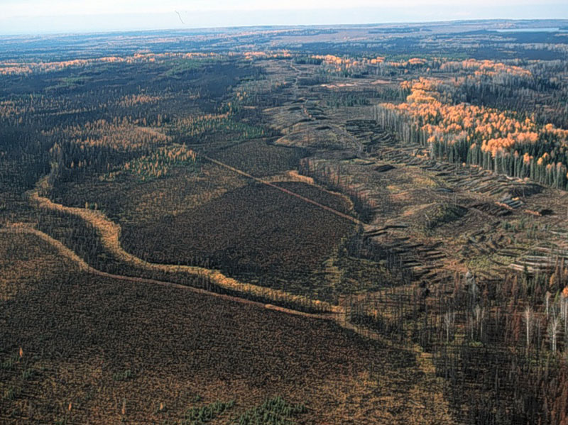
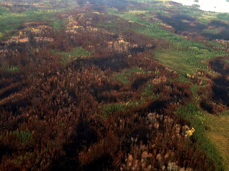
Forest managers across the Canadian boreal require detailed fire pattern information to support disturbance-based management. However, there are no consistent classifications of post-fire patterns, and those that exist rely on field-data that is both expensive and lacking in spatial representation. As a result, across the managed boreal forest there is limited fire pattern information, no standardized protocols to derive the quantitative fire pattern information nor agreement on the most appropriate metrics needed to implement management planning based on emulating natural disturbances. In this paper we first derived three classes of tree mortality based on Landsat spectral data and aerially photo-interpreted (API) polygons. Next we used these derived classes to compute seven fire pattern metrics over 14 fires that occurred from 1984 to 2006 in the Canadian provinces of Alberta and Saskatchewan, Canada. We then compared the metrics derived from the Landsat data to those computed from the API coverage. Lastly, we assessed the influence of a suite of environmental and fire pattern variables on the Landsat-derived indices. Overall we found very close correspondence for the two event-scale indices: the total area affected by fire and the complexity of the perimeter. The more detailed within-fire event metrics presented more varied results and were somewhat less precise. For example, the total amount of residuals or the largest disturbed patch were accurately captured. Other indices such as the number of disturbed patches or total amount of island remnants presented moderate systematic biases, but still might be serviceable given that the biases were predictable in direction. Fire size and seasonal drought variables were the most correlated with the Landsat derived pattern indices and their inclusion as model variables is likely to increase overall prediction accuracy. A pan-boreal geospatial database of detailed fire pattern metrics would be an invaluable tool to support the implementation of disturbance-based management approaches. Here we demonstrate that a cost-effective Landsat methods produces comparable fire pattern information to conventional approaches based on manual interpretation of aerial photographs. Building upon the standardized methods proposed here hundreds of fires could be mapped, to potentially, create a comprehensive national fire pattern database.
Citation
Ignacio San-Miguel, David W. Andison, and Nicholas C. Coops. 2017. Characterizing historical fire patterns as a guide for harvesting planning using landscape metrics derived from long term satellite imagery. Forest Ecology and Management. 399 (2017) 155–165. https://doi.org/10.1016/j.foreco.2017.05.021