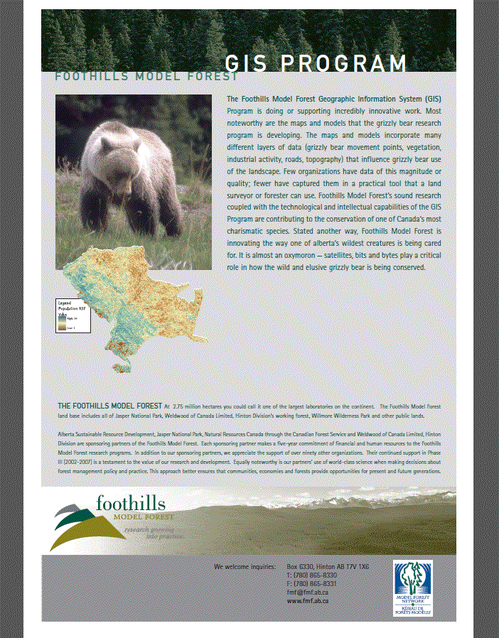
Foothills Model Forest: GIS Program Posters on the maps and models being created using data from the Grizzly Bear Research Program. Gallery Downloads GIS_2004_06_Pstr_GISProgramFMF_thumb.gif GIS_2004_06_Pstr_GISProgramFMF.pdf Author Foothills Model Forest Published Jun 01, 2004 Record Type Summaries and Communications Posters Related Programs GIS Services