Paper presented at the ESRI 2006 International User Conference in San Diego, California.
Abstract
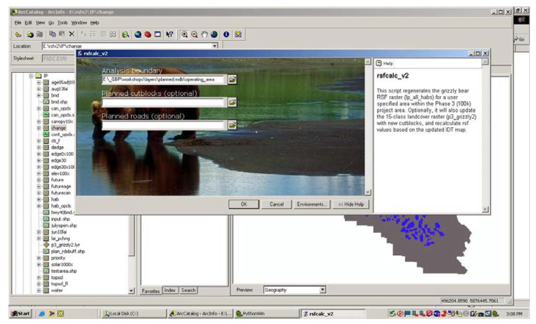
Since 1999, the Foothills Model Forest Grizzly Bear Research Program (FMFGBRP) has been studying grizzly bears (Ursus arctos) in order to provide land managers with the knowledge and tools to ensure the long-term conservation of this species in Alberta. Raster-based GIS maps have been created, covering 55% of the grizzly bear range in Alberta, that combine GPS locations with Remote Sensing imagery to model two aspects of grizzly bear habitat quality – resource availability, and security – as a function of landscape variables such as vegetation, terrain, and human access. The FMFGBRP has developed a script that incorporates proposed development scenarios into landscape variables and regenerates the habitat models based on these new inputs.
View paper online.