Paper presented at the ESRI 2002 International User Conference in San Diego, California
Abstract
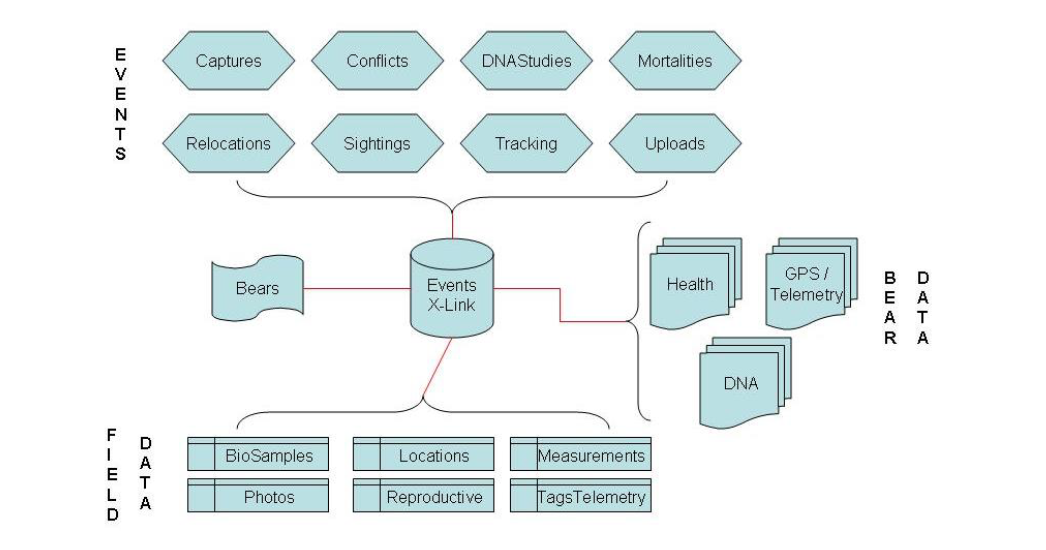
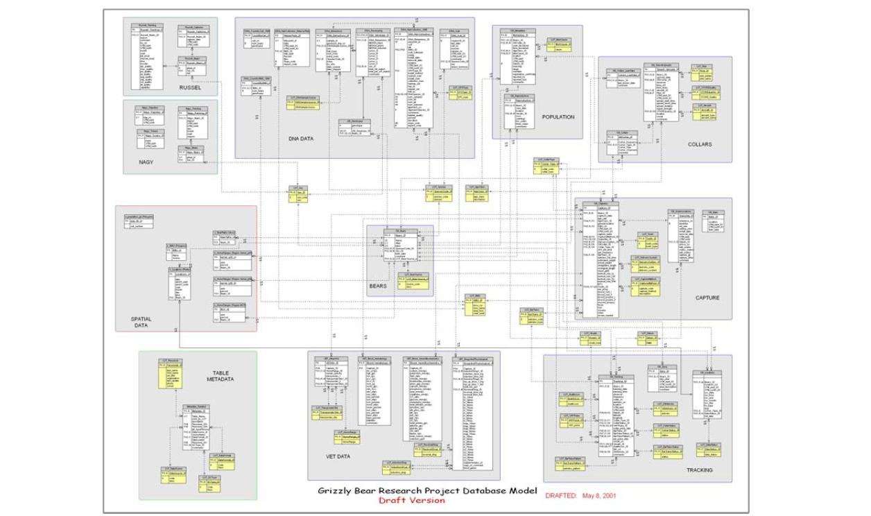
The Foothills Model Forest (FMF) Grizzly Bear Research Project manages large data sets derived from GPS radio telemetry collars on grizzly bears. Efficient data handling and management techniques are essential in maintaining the integrity and accuracy of the data and to facilitate single-source spatial analysis, querying and reporting. Through ArcInfo and ODBC datasource connections with Microsoft Access, the raw GPS point data are imported, re-projected and stored directly in a database. Biologists and other scientific collaborators have benefited from the techniques and applications developed to address research questions. The FMF is a non-profit organization that works to advance the goal of sustainable forestry through on-the-ground research.
View publication online.