By Dan Wismer
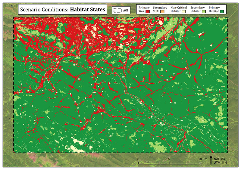
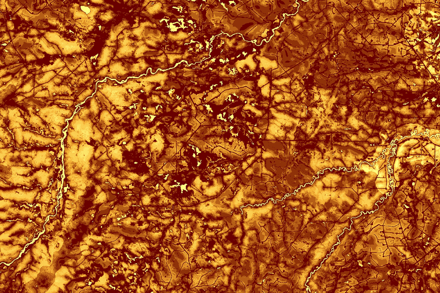
Open road density has been linked to grizzly bear morality risk in Alberta. Motorized road access developed for resource extraction increases human-bear conflict and impacts survival rates. Road densities (km/km2) < 0.6 in core and < 0.75 in secondary habitat are threshold indicators used for land management decisions aimed at supporting grizzly bear conservation.
Alberta’s grizzly bear watershed units (gbwu) are conservation boundaries which are split into core and secondary habitat zones. Analyzing open road density at the gbwu scale and viewing change helps inform land management on grizzly bear mortality risk and indicates where mitigations efforts are needed.
Using ABMI HFI road centerlines, features were filtered by year, road length was extracted and density generated for each gbwu. Winter roads and truck-trails were excluded. Roads that did not have a year attribute were considered to be on the landscape before the year 2000.
Road density metrics were then mapped and percent change between years graphed:

Fig 1: Gbwu 2000 road density

Fig 2: Gbwu 2018 road density

Fig 3: Road density percent change grouped by Bear mgmt. unit – gbwu – year

Fig 4: Road density percent change grouped by habitat – gbwu – year
Viewing these output summaries, the most change occurred after 2014 in core habitat; where in 2018, 13 gbwu are over the open road density threshold. Road density continues to climb year after year, with many gbwu trending to surpass their maximum threshold. Resource managers can look to restoring roads or restricting motorized access to reduce density values and help lower the risk of human caused mortalities for grizzly bears and increasing their survival.

Fig 5: Gbwu road density change animation between 2014–2018
To conduct your own gbwu road density analysis, look for the road density tool in GBTools to streamline this workflow.